PAGASA Releases Latest Weather Update for Thursday (July 22)
The state weather bureau PAGASA reported that Typhoon Fabian maintained its strength as it moves west southwestward.
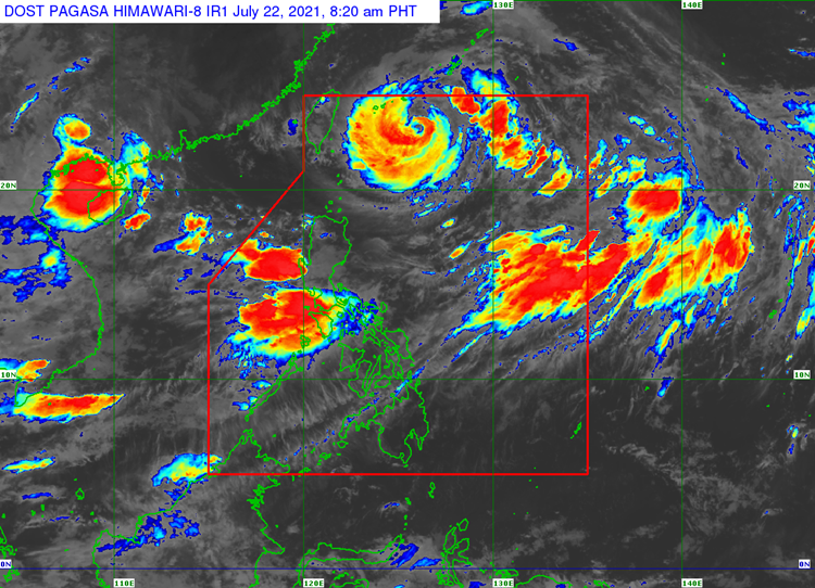
On Thursday (July 22, 2021), the Philippine Atmospheric, Geophysical and Astronomical Services Administration released the latest weather update in the country. Typhoon Fabian would continue to enhance the southwest monsoon.
Typhoon Fabian has maximum sustained winds of 150 kilometers per hour and gustiness of up to 185 kph. It has been last spotted at 530 kilometers northeast of Itbayat, Batanes.
Fabian enhances the southwest monsoon that would bring monsoon rains over Ilocos Region, Abra, Benguet, Zambales, Bataan, Tarlac, Pampanga, Bulacan, Metro Manila, Cavite, Batangas, Occidental Mindoro, Oriental Mindoro, Romblon, and the northern portion of Palawan including Calamian and Kalayaan Islands in the next 24 hours.
Habagat would also bring cloudy weather conditions with scattered rainshowers and thunderstorms over Western Visayas and the rest of Luzon. The remaining parts of the country would have partly cloudy to cloudy conditions with rainshowers or thunderstorms.
PAGASA also advised the residents of Metro Manila, Ilocos Region, MIMAROPA, Benguet, Abra, Zambales, Bataan, Tarlac, Pampanga, Bulacan, Cavite, and Batangas for possible flash floods or landslides due to moderate to heavy rains.
Read Also: PAGASA Says Typhoon Fabian Slightly Weakened, Habagat to Bring Brains Over Parts of Ph
The tropical cyclone is expected to leave the Philippine Area of Responsibility on Friday evening (July 23) or Saturday (July 24).
What can you say about the latest weather update? Just feel free to leave your comments and reactions to this article.
Read Also: PAGASA Says Fabian Moves West-Northwest, Habagat to Bring Monsoon Rains Over Parts of PH