PAGASA Releases Latest Update About Tropical Storm Dante
The state weather bureau PAGASA reported that the Tropical Storm Dante would continue to bring rains over some parts of the country.
On Friday (June 4, 2021), the Philippine Atmospheric, Geophysical and Astronomical Services Administration released the latest weather update in the country. Tropical Storm Dante would continue to affect the country’s weather condition.
PAGASA reported that Tropical Storm Dante has been last spotted at 285 kilometers northwest of Laoag City, Ilocos Norte or 325 km West of Calayan, Cagayan outside the Philippine Area of Responsibility.

Dante has maximum sustained winds of 65 kilometers per hour and gustiness up to 80 kph moving 20 kph at a northward direction. It is expected to re-enter PAR due to a high-pressure area.
The weather disturbance would bring cloudy weather condition with scattered rainshowers and thunderstorms over Ilocos Region, Zambales and Bataan. Possible flash floods or landslides are expected due to light to moderate to occasionally heavy rains.
The localized thunderstorms would also bring partly cloudy to cloudy condition with isolated rainshowers over the entire Visayas, Occidental Mindoro, Palawan and Kalayaan Group of Islands.
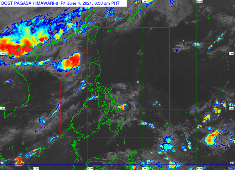
Metro Manila and the remaining parts of the country would also experience similar weather condition, according to the weather bureau.
Meanwhile, the coastal water conditions over the northern and western sections of Northern Luzon would be moderate to rough. The surrounding sea conditions over the rest of the archipelago would be slight to moderate.
What can you say about the recent weather update? Just feel free to leave your comments and reactions to this article.
Read Also: PAGASA Says Tropical Storm Dante Hits Luzon & Slightly Accelerates