PAGASA Releases Latest Weather Update for Wednesday (May 7, 2025)
PAGASA LATEST UPDATE – The state weather bureau reported that two low-pressure areas will bring rains over parts of the country.
On Wednesday (May 7, 2025), the Philippine Atmospheric, Geophysical and Astronomical Services Administration released the latest weather update in the country. Two low-pressure areas will affect the country’s weather conditions.
PAGASA weather specialist Benison Estareja reported that two low-pressure areas were monitored inside the Philippine area of responsibility. The two weather disturbances were located at 425 kilometers west off Iba, Zambales and over the waters off Kalibo, Aklan.

The low-pressure area off Zambales is expected to leave the country’s vicinity within 24 hours. The LPA off Aklan would bring rains and will stay within the Visayas area before dissipating.
The two weather disturbances will bring cloudy skies with scattered rains and thunderstorms over Visayas, Bicol Region, MIMAROPA, and Quezon.
“It will only stay within the Visayas area and Mimaropa area until it dissipates until tomorrow noon or afternoon,” he added.
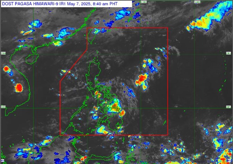
“This low-pressure area, while also not expected to be a tropical cyclone, is expected to bring rains in most parts of southern Luzon and Visayas,” Estareja said
The easterlies will bring similar weather conditions over CARAGA. It will also bring partly cloudy to cloudy skies with isolated rainshowers or thunderstorms over Metro Manila and the rest of the country.
The weather agency has warned the public of possible flash floods or landslides due to moderate to, at times heavy rains.
Meanwhile, the coastal water condition over the western section of Luzon, the rest of Luzon, the eastern sections of Visayas and Mindanao, as well as the remaining parts of the country will be slight to moderate.
No gale warning was raised over any of the country’s seaboard, according to PAGASA.
RELATED POST: PAGASA Releases Latest Weather Update for Tuesday (May 6, 2025)