PAGASA Says Tropical Storm Nakri to Affect PH Weather Condition
PAGASA LATEST UPDATE – The state weather bureau reported that Tropical Storm Nakri will bring rain over parts of the country.
On Friday (October 10, 2025), the Philippine Atmospheric, Geophysical and Astronomical Services Administration released the latest weather update in the country. Tropical Storm Nakri and a new LPA will affect the country’s weather condition.
PAGASA weather specialist Grace Castañeda reported that Tropical Storm Nakri has exited the Philippine Area of Responsibility. It was last spotted 1,355 km East Northeast of Extreme Northern Luzon.

Quedan has maximum sustained winds of 75 kilometers per hour and gustiness of up to 90 kph, moving north northwestward at 20 kph.
A trough of a low-pressure area will affect Southern Luzon and the Southwesterly Windlow will bring cloudy weather conditions with scattered rains and thunderstorms in the Visayas and Mindanao.
Similar weather condition is expected over Metro Manila, Central Luzon, CALABARZON, Bicol Region and the rest of MIMAROPA.
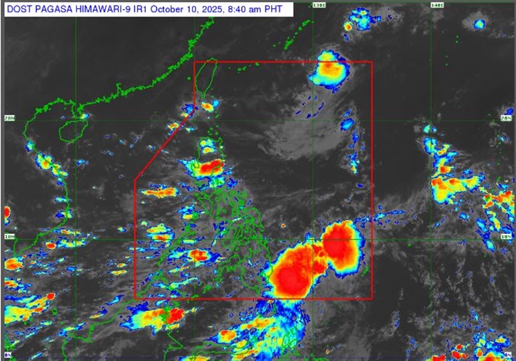
A new low-pressure area was last spotted 335 kilometers west-northwest of Pag-asa Island in Kalayaan, Palawan. It has a slim chance of becoming a Tropical Depression within the next 24 hours.
“We can see that it will not develop into a full-fledged storm, and its movement is northward, we also do not see it entering our area of responsibility,” Castañeda said.
The weather agency advised the residents in the affected areas to take precautionary measures for possible flash floods or landslides due to moderate to at times heavy rains.
The coastal water condition across the country will be slight to moderate, according to PAGASA.
RELATED ARTICLE: PAGASA Releases Latest Weather Update for Wednesday (October 8, 2025)