PAGASA Says LPA and Habagat to Affect PH Weather Condition
PAGASA LATEST UPDATE – The state weather bureau reported that a low-pressure area and habagat will bring rains all over the country.
On Monday (August 12, 2024), the Philippine Atmospheric, Geophysical and Astronomical Services Administration released the latest weather update in the country. A low-pressure area and the southwest monsoon will affect the country’s weather condition.
PAGASA weather specialist Obet Badrina reported that Habagat is affecting Luzon and the western section of Visayas while localized thunderstorms will affect the rest of the country.

A low pressure area (LPA) is being monitored and located at 1,375 kilometers east of Extreme Northern Luzon as of 3 a.m.
“Itong low pressure area na ito ay malaki ang tsansang maging bagyo ngayong araw na ito,” said Badrina.
Badrina said that when the LPA intensifies into a tropical cyclone, it will be the fourth storm this year. “Pero possible din na ito ay palabas na ng Philippine area of responsibility,” Badrina explained.
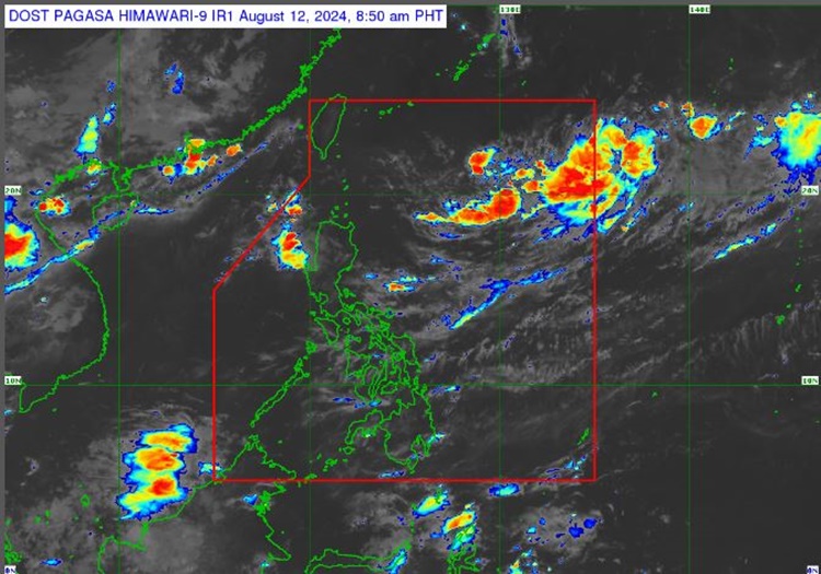
Currently, the LPA has no direct effect in the country.
Cloudy weather condition with scattered rains and thunderstorms are expected over Ilocos Region, Zambales, and Bataan. Flash floods or landslides are possible due to moderate to at times heavy rains.
Partly cloudy to cloudy skies with isolated rainshowers or thunderstorms are expected over Metro Manila, the rest of Luzon, Western Visayas, and Negros Island Region.
The remaining parts of the country will experience similar weather condition. Possible flash floods or landslides are expected in these areas during severe thunderstorms.
Meanwhile, the coastal water condition over the entire country will be slight to moderate. Pagasa did not raise a gale warning in any seaboards of the country.
READ ALSO: PAGASA Releases Latest Weather Update for Saturday (August 10, 2024)