PAGASA Releases Latest Weather Update for Thursday (July 1)
The state weather bureau PAGASA reported that a low-pressure area entered the Philippine Area of Responsibility, no significant impact is expected.
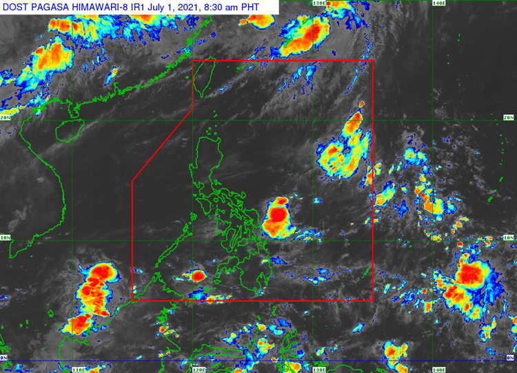
On Thursday (July 1, 2021), the Philippine Atmospheric Geophysical and Astronomical Services Administration released the latest weather update in the country. A low-pressure area has entered the country’s vicinity.
PAGASA reported that the low-pressure area has been last spotted 1,365 kilometers east of extreme Northern Luzon. It is not expected to intensify in the next 24 hours but it might dissipate in 48 hours.
The southwest monsoon would bring partly cloudy to cloudy skies with isolated rainshowers or thunderstorms over Bicol Region, Northern Samar, Oriental Mindoro, Marinduque and Romblon.
The localized thunderstorms would bring similar weather condition over Visayas, Palawan including Kalayaan Islands, and Occidental Mindoro. Metro Manila and the rest of the country would also experience the same weather condition.
Habagat may also cause possible flash floods or landslides during to severe thunderstorms.
Meanwhile, the weather agency also reported that the coastal water condition over the entire archipelago would be slight to moderate.
What can you say about the recent weather update? Just feel free to leave your comments and reactions to this article.
Read Also: PAGASA Monitors LPA at Northern Luzon, Most Parts of PH Expects Fair Weather