Newest Update On Typhoon Paeng Issued By PAGASA
The state weather bureau PAGASA has issued the newest update about Typhoon Paeng affecting the current weather condition.
On Wednesday afternoon (September 26, 2018), the Philippine Atmospheric, Geophysical and Astronomical Services Administration (PAGASA) released the latest updates about Typhoon Trami (Paeng).
PAGASA reported that Typhoon Paeng has slightly weakened as it continues to move slowly across the country’s territory.
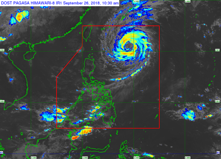
Paeng has maximum sustained winds of 160 kilometers per hour (kph) and gustiness of up to 195 kph moving slowly at a North direction.
The typhoon was last spotted 735 km East of Basco, Batanes and expected to bring light to moderate rains over Northern Luzon on Friday (September 28, 2018).

Here is the forecast position of Typhoon Trami:
- 24 Hours – 740 km East of Basco, Batanes
- 48 Hours – 670 km East Northeast of Basco, Batanes
- 72 Hours – 630 km North Northeast of Basco, Batanes
- 96 Hours – 1,145 km North Northeast of Basco, Batanes
As of now, there is no tropical cyclone warning signal has been raised in any parts of the country.
What can you say about this? Just feel free to leave your comments and reactions to this article.