Tropical Storm Ramil Latest Weather Update
Here is the latest update regarding Tropical Storm Ramil issued by the Philippine Atmospheric, Geophysical and Astronomical Services Administration (PAGASA).
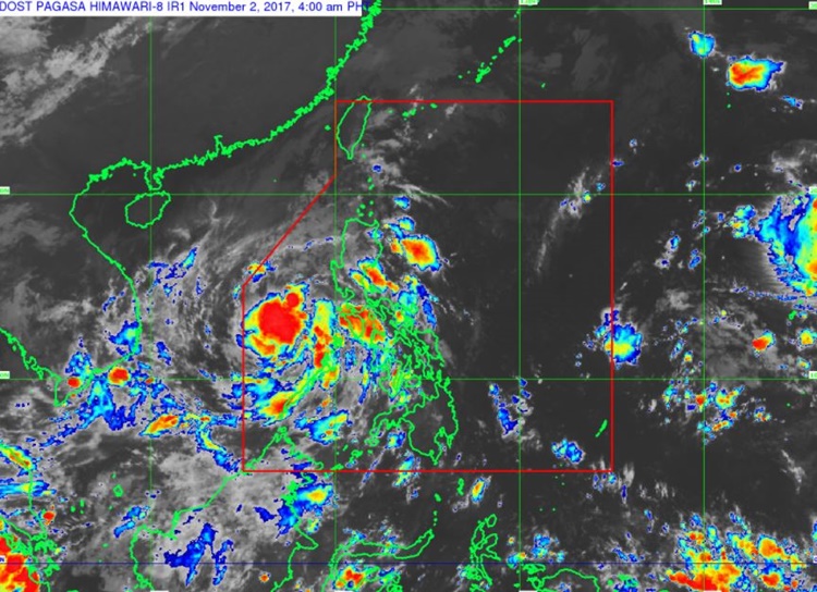
Around 5:00 am on Thursday early morning (November 02, 2017), the state weather bureau PAGASA announced that ‘Tropical Storm Ramil’ has maintained its strength and last spotted over the West Philippine Sea.
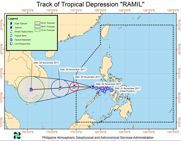
Pagasa said that the center of the tropical depression was at 230 km West of Coron, Palawan (12.2 °N, 118.1 °E) based on all available data.

The weather agency forecasted that Ramil was moving 15 kilometers per hour (kph) West with maximum sustained winds of 55 kph near the centers and could gusts up to 65 kph.
The tropical depression was expected to leave the Philippine Area of Responsibility (PAR) on Friday morning (November 03, 2017).
Bagyong Ramil would be 155 km North Northeast of Pagasa Island, Palawan outside PAR on Friday morning.

On Saturday morning (November 04, 2017), the tropical storm would be at 285 km West Northwest of Pagasa Island, Palawan and on Sunday morning (November 05, 2017) it would move 725 km West of Pagasa Island, Palawan.
Mindoro Provinces, Palawan, Batangas, Northern Quezon including Polillo Island and Aurora could experience from moderate to occasionally heavy rains. The resident in the affected areas was alerted of possible flash floods and landslides.
While Metro Manila and the rest of Luzon could experience from light to moderate and occasional heavy rains.
What can you say about this? Just feel free to leave your comments and reactions for this article.
You can also read President Duterte Urges Filipinos To Be Agents Of Change On All Souls’ Day
