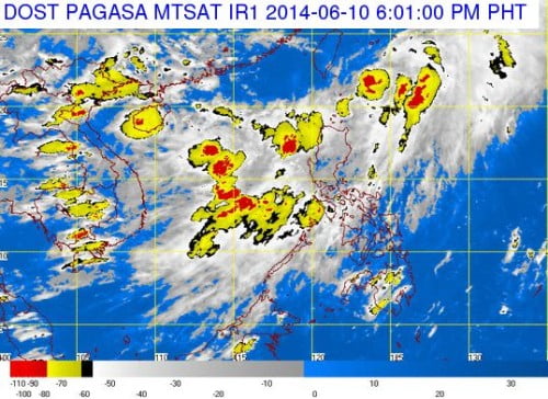
The Philippine Atmospheric Geophysical and Astronomical Services Administration (PAGASA) confirmed that the low-pressure (LPA) off Northern Luzon intensified into a Tropical Depression before noon on Tuesday, June 10, 2014. The Tropical Depression has been given by PAGASA the local codename, Ester.
According to PAGASA forecaster Buddy Javier, the agency raised Storm Signal No. 1 in the areas over Batanes, Calayan, and Babuyan Islands in extreme Northern Luzon areas.
The Bagyong Ester was spotted at 120 kilometers North of Basco, Batanes as of 10:00 AM. The areas affected by Storm Signal No. 1 should expect 30 to 60 kilometers per hour (kph) with winds the next 36 hours.
The latest tropical depression that hits the Philippines is moving northeast at 20 kph, it is expected to at 540 kms northeast of Basco, Batanes on Wednesday morning, on June 11, 2014. PAGASA noted that the Bagyong Ester will be outside of Philippine area of responsibility on Thursday morning.
The Tropical Depression Ester was packing a maximum sustained winds of 65 kph near the center and gusts of up to 80 kph. Bagyong Ester is expected to enhance the southwest monsoon (habagat). The interaction will trigger moderate to heavy rains over Ilocos Region and in the provinces of Zambales and Bataan.

