Heavy rainfall and strong winds brought by Typhoon Jenny and the wind signals are still up.
The Philippine Atmospheric, Geophysical, and Astronomical Services Administration (PAGASA) released recent data about Typhoon Jenny.
Forecasted to leave the Philippine area of responsibility (PAR) by tomorrow is Typhoon Jenny. This typhoon brought heavy rainfall and strong winds over Batanes and Northern Luzon.
The location of the center at 4 PM was estimated to be 155 km north-northeast of Itbayat, Batanes.
The typhoon has a maximum sustained winds of 155 km/h near the center and gustiness of up to 190 km/h moving westward at 15 km/h.
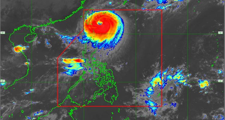
Based on the data from the Philippine Atmospheric, Geophysical, and Astronomical Services Administration (PAGASA), in the 12-hour forecast of the typhoon, the center is located 175 km north-northwest of Itbayat, Batanes while in the 24-hour forecast, the center will be at 255 km northwest of Itbayat, Batanes. By this time, it is already outside PAR
As of the latest weather bulletin, tropical cyclone wind signals are in effect in these areas:
- Signal No. 1
- The rest of Babuyan Islands, the northern portion of mainland Cagayan (Santa Ana, Gonzaga, Buguey, Santa Teresita, Lal-Lo, Camalaniugan, Pamplona, Claveria, Aparri, Ballesteros, Abulug, Allacapan, Sanchez-Mira, Santa Praxedes, Lasam, Gattaran), the northern portion of Apayao (Calanasan, Pudtol, Luna, Santa Marcela, Flora), and the northern portion of Ilocos Norte (Piddig, Bangui, Vintar, Burgos, Pagudpud, Bacarra, Adams, Pasuquin, Carasi, Dumalneg, Laoag City)
- Signal No. 2
- The rest of Batanes and the northern portion of Babuyan Islands (Babuyan Is., Calayan Is.)
- Signal No. 3
- The northern portion of Batanes (Itbayat)
Outside PAR, Jenny will move west to the Taiwan Strait and the coastal waters of southeastern China.
What can you say about this? Let us know!
For more news and updates, follow us on Twitter: @philnews_ph Facebook: @PhilNews, and YouTube channel Philnews Ph.