PAGASA Issues Latest Weather Update in its 11 a.m Bulletin
The state weather bureau PAGASA reported that Typhoon Jenny further intensified, Signal no.1 has been raised over five areas.
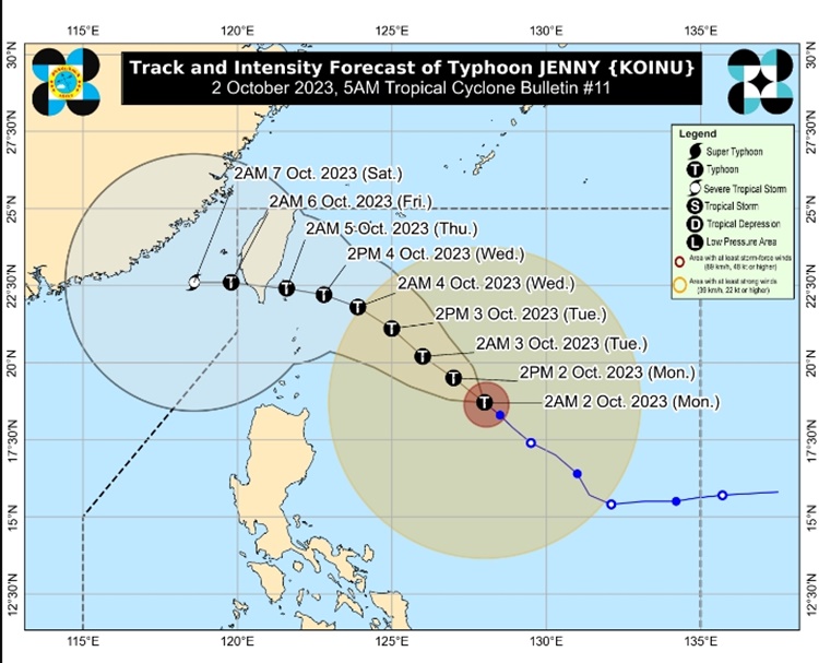
Typhoon Jenny was last located 635 kilometers east Southeast of Basco, Batanes. It packs maximum sustained winds of 140 kilometers per hour and gustiness of up to 170 kph while moving 15 kph in a northwestward direction.
“Mamayang hapon ay inaasahan natin na nasa 580 km silangan na ng Calayan, Cagayan, habang bukas ay nasa 240 km silangan ng Basco, Batanes, at 330 km silangan ng Ibtayat, Batanes hapon ng Martes,” weather specialist Obet Badrina said.

In its 11 a,m. bulletin, the Philippine Atmospheric, Geophysical, and Astronomical Services Administration announced that Tropical Cyclone Wind Signal (TCWS) No. 1 remained hoisted over five areas in Luzon.
Here is the list of areas under Signal No. 1:
- Batanes
- Cagayan including Babuyan Islands
- Northern and eastern portions of Isabela
- Apayao
- Northern portion of Ilocos Norte
Jenny will continue to enhance the southwest monsoon, which will trigger rains over western portions of Central Luzon, Southern Luzon, Visayas, and Mindanao.
Visayas, Zamboanga Peninsula, and Mimaropa will experience cloudy weather conditions with scattered rain showers and thunderstorms due to the enhanced habagat.
Metro Manila and the rest of the country will have partly cloudy to cloudy skies with isolated rain showers or thunderstorms due to the extension of Typhoon Jenny.
The typhoon is expected to exit the Philippine area of responsibility on Friday (October 6, 2023).
PAGASA also raised gale warnings over the seaboards of Batanes and Babuyan Islands.
The social media users expressed their reactions to the latest weather update:


This is a developing report, just visit this website regularly for further updates and information.
Thank you for visiting Philippine Trending News (Philnews.ph). You may also follow us on the following social media platforms; Facebook, Twitter, and YouTube