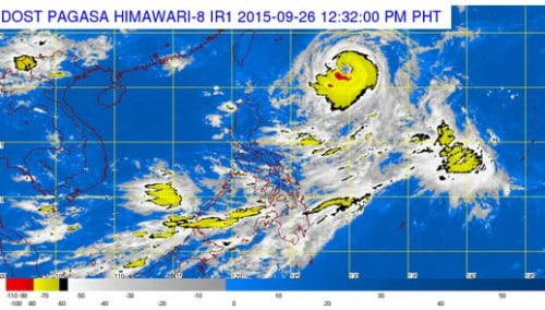
The country’s weather bureau, Philippine Atmospheric, Geophysical and Astronomical Services Administration (PAGASA) forecast that Bagyong Jenny (international name Dujuan) maintained its strength as it move northwest but slowed slightly on Saturday morning.
PAGASA reported that as of 4:00 AM, Bagyong Jenny was at 965 kilometers east of Itbayat, Batanes, moving northwest at 9 kph, with maximum sustained winds of 130 kph near the center and gusts of up to 160 kph.
The latest weather disturbance that hits the Philippines, Bagyong Jenny will enhance the southwest monsoon, bringing rainy conditions over Palawan, the Western Visayas, and the Zamboanga Peninsula, where flash floods and landslides will be a danger.
PAGASA noted that there will be cloudy conditions over Aurora, Quirino, the Calabarzon, Bicol Region, Mindoro, Marinduque, Romblon, the rest of the Visayas and Mindanao will be accompanied by light to moderate rain and isolated thunderstorms.

