PAGASA released the latest update about Wilma PH and the areas that are under Signal No. 1.
WILMA PH UPDATE – PAGASA has released an update about the tropical depression and the areas that are in Signal No. 1.
The Philippine Atmospheric, Geophysical, and Astronomical Services Administration (PAGASA) released the latest update about Tropical Depression Wilma. Based on its 5 PM update on December 4, Wilma decelerates while moving over the Philippine Sea East of Northern Samar.
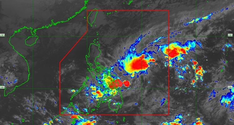
At 4, the location of its center was at 575 km East of Catarman, Northern Samar (12.3°N, 129.9°E), moving west southwestward at 10 km/h. It has maximum sustained winds of 45 km/h near the center, gustiness of up to 55 km/h, and a central pressure of 1004 hPa.
TROPICAL CYCLONE WIND SIGNALS (TCWS) IN EFFECT
Signal No. 1
- Luzon
- The southern portion of mainland Masbate (Cataingan, Pio V. Corpuz, Esperanza, Placer)
- Visayas
- Northern Samar, Eastern Samar, Samar, Biliran, Leyte, Southern Leyte, the northern portion of Cebu (Daanbantayan, Medellin, City of Bogo, San Remigio, Tabogon, Borbon, Tabuelan, Tuburan, Sogod, Catmon, Asturias, Carmen, Danao City, Balamban, Compostela, Liloan, Consolacion, Cebu City, Mandaue City, Cordova, Lapu-Lapu City) including Bantayan and Camotes Islands, and the eastern and central portions of Bohol (Inabanga, Sagbayan, Carmen, Garcia Hernandez, Jagna, Sierra Bullones, Pilar, Duero, Guindulman, Anda, Candijay, Mabini, Alicia, Ubay, Pres. Carlos P. Garcia, San Miguel, Dagohoy, Danao, Buenavista, Getafe, Trinidad, Talibon, Bien Unido)
- Mindanao
- Surigao del Norte including Siargao and Bucas Grande Islands, Dinagat Islands, the northern portion of Surigao del Sur (Carrascal, Cantilan, Madrid, Carmen), and the northern portion of Agusan del Norte (Kitcharao, Jabonga, Santiago, Tubay, City of Cabadbaran
According to the forecast, Wilma will continue to move west southwestward until Saturday and then turn westward for the remaining forecast period. It may make landfall initial landfall in Eastern Visayas or the Dinagat Islands between tomorrow evening and Saturday morning.
It will remain as a tropical depression throughout the forecast.
What can you say about this? Let us know in the comments!