PAGASA Releases Latest Weather Update for Friday (July 23)
The state weather bureau PAGASA reported that Typhoon Fabian continues to enhance habagat that would bring monsoon rains over some parts of the country.
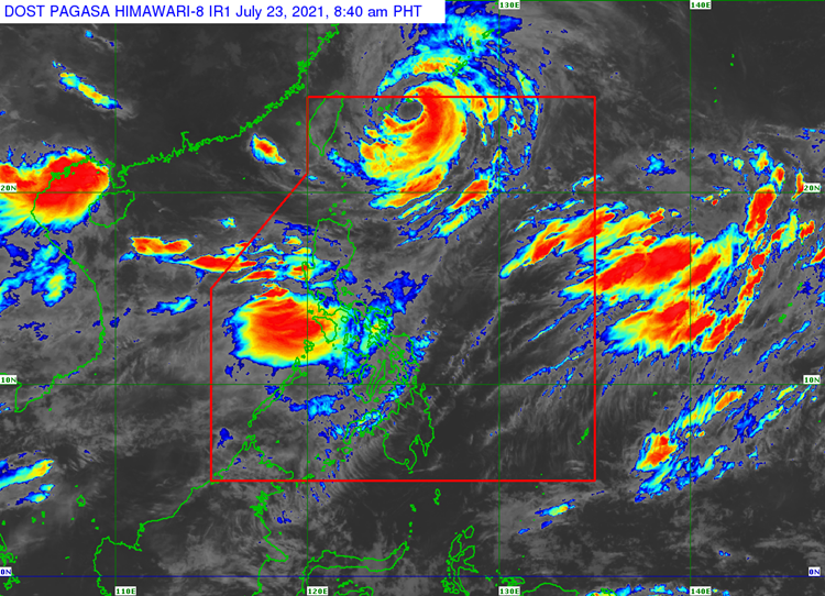
On Friday (July 23, 2021), the Philippine Atmospheric, Geophysical and Astronomical Services Administration released the latest weather update in the country. Typhoon Fabian and the southwest monsoon would continue to affect the country’s weather condition.
Typhoon Fabian has been last spotted 495 kilometers northeast of Itbayat, Batanes. It has maximum sustained winds of 150 kilometers per hour and gustiness of up to 185 kph moving at a west northwestward direction.

Tropical Cyclone Wind Signal (TCWS) No. 1 remains over Batanes and Babuyan islands. Rains and strong winds are expected in these areas due to the effects of the tropical cyclone.
The enhanced southwest monsoon would bring monsoon rains over Metro Manila, Ilocos Region, Benguet, Abra, Zambales, Bataan, Tarlac, Pampanga, Bulacan, Rizal, Laguna, Cavite, Batangas, Mindoro Provinces and Northern Palawan including Calamian and Kalayaan Islands.
Habagat would also bring cloudy weather condition with scattered rainshowers and thunderstorms over Western Visayas and the rest of Luzon. The remaining parts of the country would experience partly cloudy to cloudy skies with rainshowers or thunderstorms.
Read Also: PAGASA Says Typhoon Fabian Slightly Weakened, Habagat to Bring Brains Over Parts of Ph
The weather agency also warned the public that sea travel remains risky. Fabian is expected to leave the Philippine Area of Responsibility on Friday night and Saturday morning (July 24).
What can you say about the latest weather update? Just feel free to leave your comments and reactions to this article.
Read Also: PAGASA Says Typhoon Fabian Maintains Strength, Signal No. 1 Still Up Over Batanes & Babuyan Islands