PAGASA Releases Latest Weather Update for Thursday (June 24)
The state weather bureau PAGASA reported that one to three tropical cyclones are expected to enter PAR in July 2021.
On Thursday (June 24, 2021), the Philippine Atmospheric, Geophysical and Astronomical Services Administration said that one to three tropical cyclones would enter the Philippine Area of Responsibility next month.
The tropical cyclones would affect the weather condition over Northern Luzon or Eastern Visayas and could intensify the effects of the southwest monsoon. Neutral El Niño/Southern Oscillation conditions would last until November 2021.
Meanwhile, the southwest monsoon would bring cloudy weather condition with scattered rainshowers and thunderstorms over Occidental Mindoro, Northern Palawan including Kalayaan Islands.
The habagat would also bring similar weather conditions over Ilocos Region, Apayao, Abra, Benguet, Cagayan, Bataan, Zambales, Occidental Mindoro, and Northern Palawan including Kalayaan Islands.
The localized thunderstorms would bring partly cloudy to cloudy skies with isolated rainshowers or thunderstorms are also expected over Visayas and the rest of Palawan.
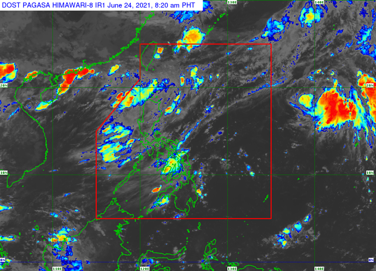
The coastal weather condition over the entire country would be slight to moderate, according to PAGASA.
What can you say about the latest weather update? Just feel free to leave your comments and reactions to this article.
Read Also: PAGASA Releases Latest Weather Update for Wednesday (June 23)