PAGASA Reports New LPA Could Intensify Into tropical Depression, May Enter PAR Next Week
The state weather bureau PAGASA reported that a new Low-Pressure Area (LPA) could intensify into tropical depression “Queenie” and may enter PAR next week.
On Friday (September 28, 2018), the Philippine Atmospheric, Geophysical and Astronomical Services Administration (PAGASA) released the latest weather update in the country.
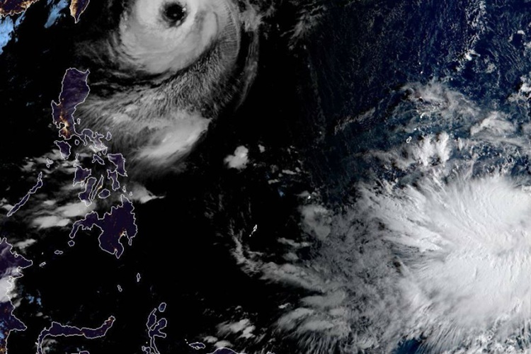
PAGASA reported that another weather system was located at 2,915 kilometers east of Mindanao could possibly intensify into a tropical depression.
The weather disturbance will be locally named “Queenie” if it intensified into a tropical depression, the possible 17th tropical cyclone to hit the country this year.
The LPA was expected to enter the Philippine Area of Responsibility (PAR) on Tuesday (October 2, 2018).
“Ito ay posibleng maging ganap na bagyo at posibleng pumasok sa Philippine area of responsibility sa Martes,” PAGASA weather specialist Meno Mendoza said.
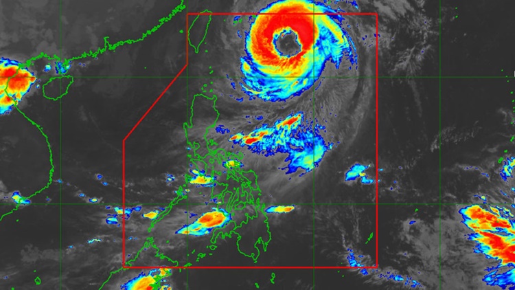
Meanwhile, Typhoon Paeng with an international name “Trami” continue to move towards southern Japan packing maximum sustained winds of 160 kilometers per hour (kph) and gustiness of 195 kph.
Paeng was last spotted at 695 kilometers east northeast of Basco, Batanes and expected to leave PAR on Saturday morning (September 29, 2018).
What can you say about this? Just feel free to leave your comments and reactions to this article.