Typhoon Mangkhut Latest Updates Released By PAGASA
The state weather bureau PAGASA has released the latest weather update regarding Typhoon Mangkhut, which is expected to hit the country within this week.
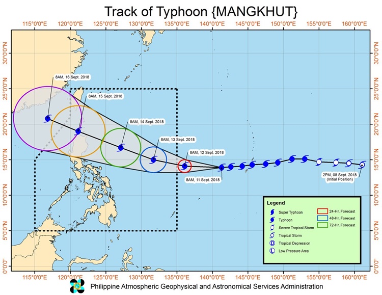
On Tuesday (September 11, 2018), the Philippine Atmospheric, Geophysical and Astronomical Services Administration (PAGASA) announced the latest update regarding Typhoon Mangkhut.
PAGASA announce that the typhoon has intensified as it moves closer to the Philippines Area of Responsibility (PAR).
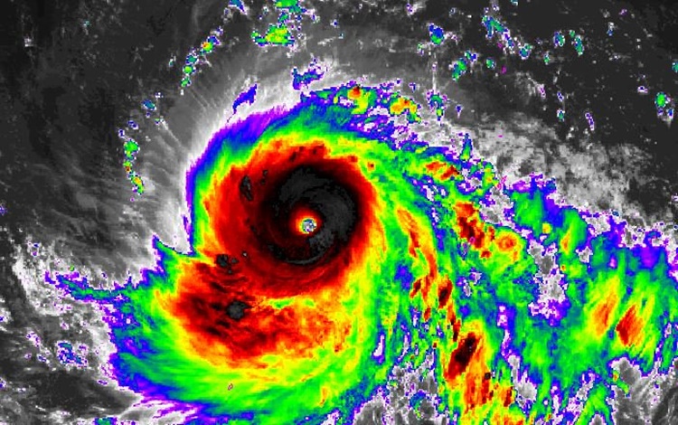
Mangkhut was last spotted at 1,845 kilometers east of southern Luzon with maximum sustained winds of 170 kilometers per hour (kph) and gustiness of 210 kph moving 25 kph at a west direction.
The typhoon will be named “Ompong” once it entered the country’s area of jurisdiction on Wednesday afternoon (September 12, 2018).
Ompong threatens to affect Northern Luzon and hit Cagayan – Batanes area during the weekend but cyclone warning signals may be raised tomorrow.
The weather disturbance may also intensify the southwest monsoon that would bring moderate rains and thunderstorms over Zamboanga Peninsula, Western Visayas, and Palawan.
You can also read PAGASA Releases Latest Updates On Typhoon Mangkhut (Sept 12)
The weather agency also considers Mangkhut as a super typhoon for carrying winds of up to 250 kph.
The National Disaster Risk Reduction and Management Council (NDRRMC) has also raised red alert status in some areas as the typhoon moves close to PAR.
What can you say about this? Just feel free to leave your comments and reactions to this article.