The Philippine Atmospheric Geophysical and Astronomical Services Administration (PAGASA) announced on Thursday, November 16, 2017, that a Low-Pressure Area (LPA) was spotted east of Mindanao and is likely to intensify into a tropical depression in the next 24 hours.
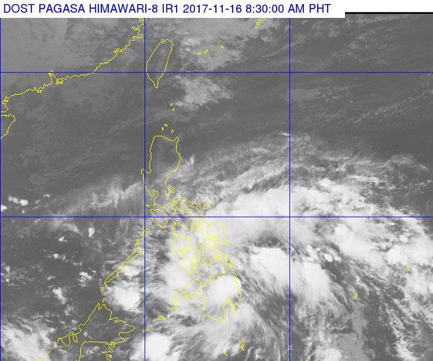
In an advisory issued by the state weather bureau at exactly 11:00 a.m., it noted that the LPA was estimated at 150km EastNortheast of Hinatuan, Surigao del Sur (8.8N, 127.6E).
The Low-Pressure Area will bring scattered moderate to heavy rains over the regions of Caraga, Northern Mindanao, Zamboanga Peninsula, Eastern and Central Visayas and Lanao del Sur.
According to the state weather bureau, maritime operations along the Bohol Sea including the seaboards of Surigao Provinces, Southern Leyte, southern Negros Oriental and Zamboanga del Norte will be disrupted.
PAGASA added that Metro Manila and the rest of Luzon and Visayas will have partly cloudy to cloudy skies with isolated rainshowers.
(Refresh this page for updates)