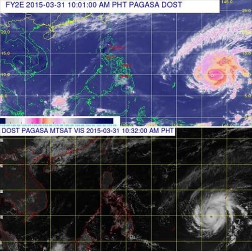
Bagyong Chedeng (international name Maysak) may enter the Philippine Area of Responsibility (PAR) on Wednesday evening or early morning of Thursday. The latest summer weather disturbance is expected to make a landfall on either Central or Southern Luzon during the weekend, but this may still change according to PAGASA.
According to PAGASA’s latest weather bulletin, Bagyong Chedeng at around 10:00 AM today, the eye of the typhoon was spotted over the Marianas Islands and located based on all available data at 1,820 km east of Northern Mindanao. It has maximum sustained winds of 175 kph near the center and gustiness of up to 210 kph.
Bagyong Chedeng (Maysak) is forecast to move west northwest at 20 kph. The typhoon is still to far to affect any part of the Philippines but is expected to enter the Philippine Area of Responsibility in the next few days.
PAGASA also noted that due to the weather disturbance, Mindanao will experience a bit cloudy, but the eastern section of the country may experience rains on Thursday and Friday. Strong winds may also be felt from Friday to Sunday.
The next update will be incorporated in the public weather forecast to be issued at 5:00 pm today while the next advisory will be issued at 11:00 am tomorrow.

