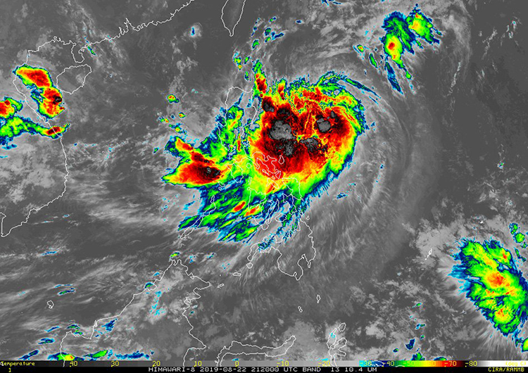
PAGASA : Ineng Now Becoming An Intense Tropical Storm
PAGASA – Weather bureau PAGASA recently announced that Ineng intensified into an extreme tropical storm on Friday (August 23).

Ineng, formerly packed with maximum sustained winds of 75 kilometers per hour and with gusts up to 90 kilometers per hour, raised up to 95 kilometers per hour of maximum sustained winds and gusts up to 115 kilometers per hour, according to weather specialist Ariel Rojas.
A report from ABS-CBN states that Signal No. 2 was raised over Batanes, which could face 60 to 120 kilometers per hour of winds within 24 hours.
The following areas still remains under Signal No.1, which could experience 30 to 60 kilometers per hour within 36 hours:
- Cagayan
- Babuyan Group of Islands
- Isabela
- Apayao
- Kalinga
- Northern Abra
- Ilocos Norte
The now tropical storm was last seen 580 kilometers east of the city of Tugegarao, Cagayan and is currently moving northwest at a speed of 20 kilometers per hour.
As per the report, as stated by Rojas, the following areas will face moderate to heavy rains:
- Batanes
- Cagayan
- Babuyan Group of Islands
- Ilocos Norte
- Apayao
Light to moderate with intermittent heavy rains will be faced by the following areas:
- Metro Manila
- Central Luzon
- Cavite
- Batangas
- Mindoro Provinces
- Northern parts of Palawan
- Calamian
- Cuyo Islands
- Ilocos Region
- Cordillera Administrative
- Cagayan Valley
The weather bureau further urged residents who are in areas prone to landslides and flood to take preventive measures and collaborate with their local disaster risk reduction and management offices.
The bureau also added that travelling by sea is also risky over the eastern starboards of Luzon and Visayas because of possible rough sea conditions.
Ineng is predicted to exit the country’s Area of Responsibility on Saturday night (August 24) or Sunday morning (August 25).
What do you think? How will you react to this? Let us know more about it.
