Uwan PH is nearing the super typhoon category
Uwan PH Update – As of 5 am on Sunday, November 9, Typhoon Uwan (Fung-wong) already has maximum sustained winds of 175 km/h.
Under the classification of a super typhoon, the storm would have maximum sustained winds of 185 km/h or above.
The Philippine Atmospheric, Geophysical, and Astronomical Services Administration (PAGASA) released the information that Uwan had maximum sustained winds of 155 kilometers per hour at 11 pm on Saturday, November 8, but this increased to 165 km/h at 2 am on Sunday, then 175 km/h as of 5 am, based on the report from Rappler.
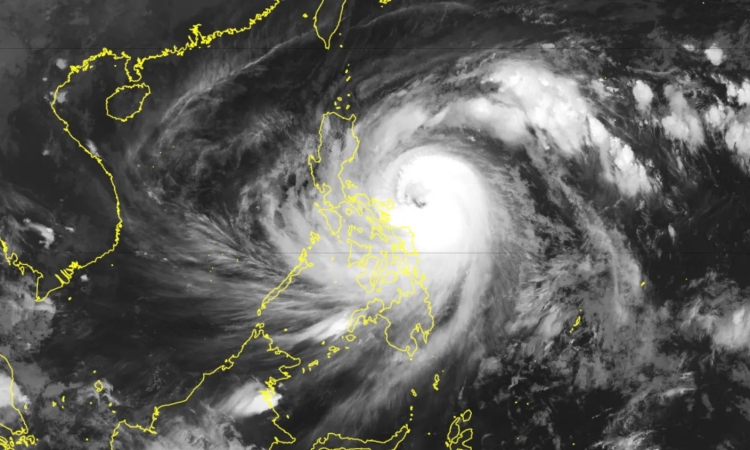
The storm was last spotted 195 kilometers east of Virac, Catanduanes, at 4 am this Sunday, and at a relatively fast 35 km/h, it is still moving west-northwest. Catanduanes is now placed under signal number 4.
The weather forecast stated that the Uwan PH is expected to pass close to Catanduanes on the morning of November 9. It is expected to make landfall in Aurora while at or near its peak intensity on Sunday evening or early morning of Monday, November 10.
PAGASA has also seen the possibility that Uwan will make landfall in Catanduanes, or it will possibly affect the province even without landfall there.
Uwan PH is forecasted to cross the mountainous terrain of Northern Luzon after hitting Aurora. Then, it would emerge over the Lingayen Gulf or the coastal waters of Pangasinan or La Union on the morning of November 10.
PAGASA stated that Uwan may weaken over landmass, but it is likely to remain a typhoon.
Previously, President Bongbong Marcos assured the public that all government agencies are under “full alert” as typhoon Uwan enters the Philippine area of responsibility.