PAGASA LATEST UPDATE – The state weather bureau reported that a frontal system will bring rains over parts of the country.
On Tuesday (May 13, 2025), the Philippine Atmospheric, Geophysical and Astronomical Services Administration released the latest weather update in the country. The frontal system will affect the country’s weather conditions.
PAGASA weather specialist Chenel Dominguez reported that the frontal system will affect parts of Northern Luzon.

The frontal system will bring cloudy skies with scattered rains and thunderstorms over Batanes, Cagayan, Ilocos Norte, Ilocos Sur, Apayao, Abra, and Kalinga.
“Pero ngayon, meron tayong frontal system na nakakaapekto dito sa may extreme northern Luzon at inaasahan natin na magdadala ito ng mga pag ulan sa ilang bahagi ng extreme northern Luzon,” said Dominguez.
The easterlies will bring partly cloudy to cloudy skies with isolated rain showers or thunderstorms over the remaining parts of the country.
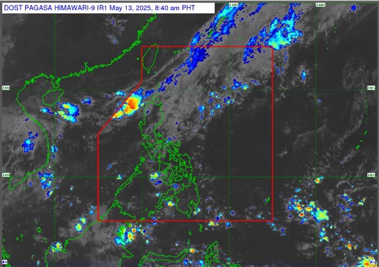
“Samantala, patuloy naman ang pag-iral ng easterlies o yung mainit at maalinsangan na hangin na nanggagaling sa dagat pasipiko dito sa malaking bahagi ng bansa,” Dominguez explained.
Hot weather will prevail over most parts of the country, but high chances of localized thunderstorms are expected in the afternoon and evening.
“Ito rin yung nagdadala sa atin ng mainit na panahon at matataas na tiyansa ng localized thunderstorms na inaasahan natin lalo na sa hapon at gabi,” she added.
The weather agency has advised the residents in the affected areas to take precautionary measures for possible flash floods or landslides due to moderate to, at times, heavy rains.
The coastal water condition over Extreme Northern Luzon will be moderate. Slight to moderate surrounding sea conditions will prevail over the rest of the country, according to PAGASA.
This is a developing report, just visit this website regularly or refresh the page for further updates.
RELATED POST: PAGASA Releases Latest Weather Update for Monday (May 12, 2025)