PAGASA Says Typhoon Carina to Bring Rains Over Parts of PH
PAGASA LATEST UPDATE – The state weather bureau reported that Typhoon Carina will bring rains over some parts of the country.
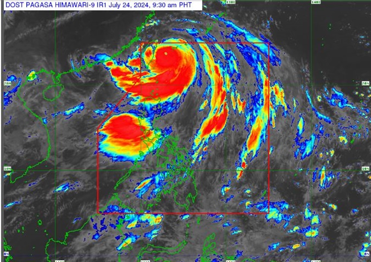
On Wednesday (July 24, 2024), the Philippine Atmospheric, Geophysical and Astronomical Services Administration released the latest weather update in the country. Typhoon Carina and habagat will affect the country’s weather conditions.
PAGASA reported that Typhoon Carina had further intensified as it continued to move towards Taiwan. Carina was estimated at 290 kilometers northeast of Itbayat, Batanes packing maximum sustained winds of 155 kilometers per hour and gustiness of up to 190 kph.

“Carina is forecast to make landfall over the northern portion of Taiwan this afternoon or early evening. On the track forecast, the typhoon will cross the rugged terrain of Taiwan and exit the Philippine area of responsibility on Wednesday evening or the early morning of July 25,” said Pagasa.
The weather agency has also raised Tropical Cyclone Wind Signal in the following areas:
TCWS No. 1
- Batanes
TCWS No. 2
- Babuyan Islands
- The northern portion of mainland Cagayan (Claveria, Santa Praxedes, Sanchez-Mira, Pamplona, Abulug, Ballesteros, Aparri, Camalaniugan, Buguey, Santa Teresita, Santa Ana, Gonzaga)
- The northern portion of Ilocos Norte (Burgos, Bangui, Pagudpud, Dumalneg, Adams)
Carina enhances habagat, which may bring moderate to intense rainfall over various areas in the western portion of Luzon. Rains and gusty winds are expected over the Batanes and Babuyan Islands.
The southwest monsoon is expected to bring scattered to widespread rains, which may cause possible flooding or landslides over the Ilocos Region, Zambales, Bataan, Abra, Benguet, and Occidental Mindoro.
Habagat will also bring occasional rains over Metro Manila, the rest of Cordillera Administrative Region, Cavite, Batangas, Tarlac, Pampanga, Bulacan, Rizal, and Laguna.
It will also bring partly cloudy to cloudy skies with isolated rain showers or thunderstorms over the remaining parts of the country.
Sea travel remains risky for small seacrafts over the coastal waters of Batanes, Babuyan Islands, and the northern portion of Cagayan due to the rough seas
The southern seaboard of Southern Luzon, the western and eastern seaboards of Visayas, and the eastern seaboard of Mindanao are advised to take precautionary measures due to moderate surrounding sea conditions, according to PAGASA.