PAGASA Releases Latest Weather Update for Tuesday (October 27)
LATEST WEATHER UPDATE – The state weather bureau PAGASA reported that another low-pressure area would enter PAR this week as Typhoon Quinta moves towards the West Philippine Sea.
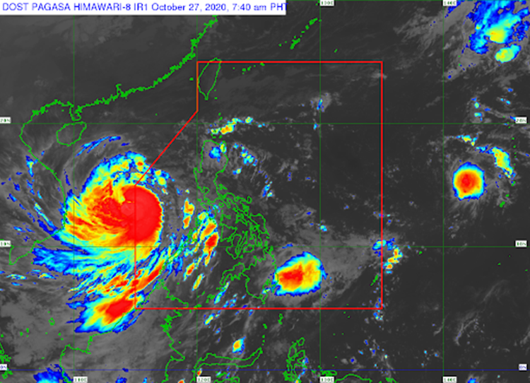
On Tuesday (October 27, 2020), the Philippine Atmospheric, Geophysical and Astronomical Services Administration reported that Typhoon Quinta continues to affect the weather country’s weather conditions as it moves towards the West Philippines Sea.
Typhoon Quinta is expected to bring moderate to heavy rains over Western Visayas, Occidental Mindoro, Palawan including Calamian, Cuyo, and Kalayaan Islands, Aurora, Isabela, Cagayan and light to moderate with at times heavy rains over Zamboanga Peninsula, Bangsamoro, Northern Mindanao, Caraga, and the rest of Luzon and Visayas.
Kalayaan Islands are still under Tropical Cyclone Wind Signal No. 1 as Typhoon Quinta is expected to leave the Philippine Area of Responsibility today. Quinta is expected to intensify within 24 hours.
Meanwhile, another low-pressure area is expected to enter the country’s vicinity this week probably Wednesday or Thursday. It may intensify into a tropical depression with the next 38 hours.
The coastal water conditions over the northern and western seaboards of Luzon would be rough to very rough seas. The eastern seaboards of Central Luzon, Southern Luzon, and Palawan as well as Western Visayas would have moderate to rough surrounding sea conditions.

What can you say about the recent weather update? Just feel free to leave your comments and reactions to this article.
Read Also: PAGASA – Typhoon Quinta Maintain Strength, Expected To Leave PAR