Have you heard of the 1976 Moro Gulf tsunami and earthquake?
1976 MORO GULF – Two(2) most devastating natural calamities that hit the Philippines are the 1976 Moro Gulf tsunami and earthquake.
As the country lies along the Pacific Ring of Fire, it is more prone to earthquakes than several other countries across the globe. The movement of plates can really be felt by the archipelago.
Thus, every day, the Philippine Institute of Volcanology and Seismology (Phivolcs) records at least ten(10) quakes rocking different parts of the country.
In the history of PH, the most devastating earthquake happened in 1976 – the Moro Gulf quake. What made it really unforgettable is that it was followed by a tsunami that cost thousands of lives.
Based on an article on Rapple, the 1976 Moro Gulf tsunami and earthquake hit the region just a few minutes past the midnight of August 17,1976. It was Tuesday when the unexpected incident took lives.
Reportedly, an 8.0 magnitude quake hit most parts of Visayas and Mindanao while most people were asleep. The people living in Cotabato City were the ones who greatly felt the shaking.
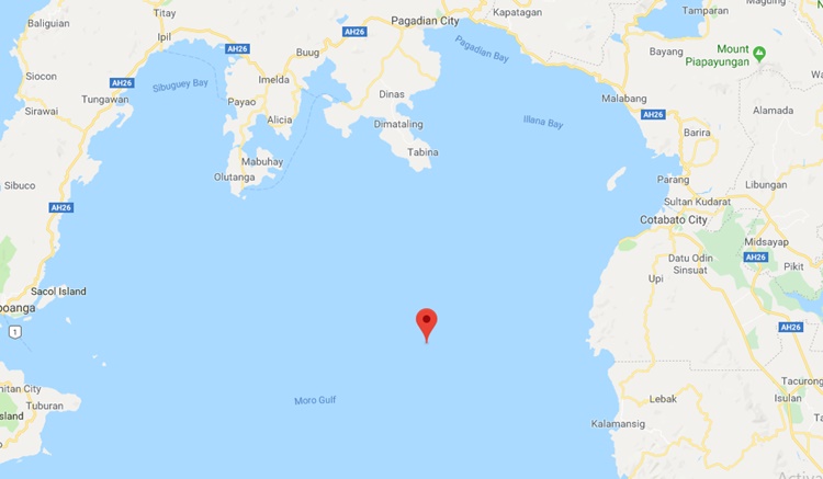
The epicenter of the quake was located near the town of Lebak in Sultan Kudarat. Just roughly two(2) to five(5) minutes after, the devastating 1976 Moro Gulf tsunami followed the earthquake.
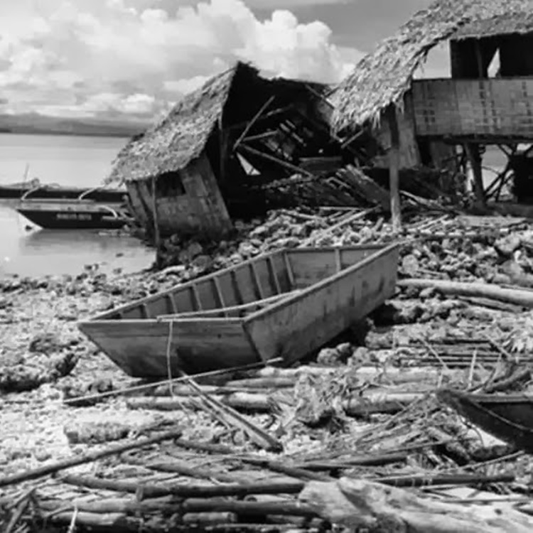
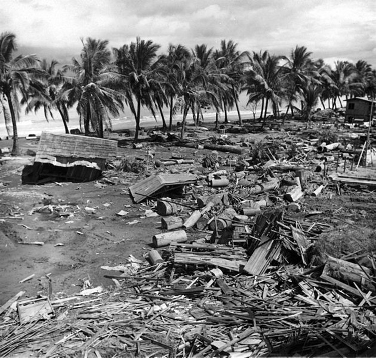
According to the report, waves as high as nine(9) meters hit the shore and affected the communities there. Sadly, the devastating natural calamities cost around 8,000 lives.
A lot of people were left dead by the unexpected incidents and many were reportedly never found again. Its effect was worse than that of Super Typhoon Yolanda which was tagged as the strongest typhoon across the globe.
According to Phivolcs Director Renato Solidum, it was a local tsunami that hit the country. The said type of tsunami occurs when there is an underwater quake. It will take between 2-20 minutes before the water will get to the shore.
Based on the report, the 1976 Moro Gulf tsunami and earthquake was followed by the strengthening of the disaster preparedness in the country.
Under former President Ferdinand Marcos in 1978, the National Disaster Coordinating Council was created. It is now known as the National Disaster Risk Reduction and Management Council.
Reportedly, the bodies of water near Cebu and Bohol can generate tsunamis and as well as landslides. In Metro Manila, a 6.5 magnitude quake can generate a tsunami with waves as high as four(4) meters.
Wherever you are, indeed, it is essential to keep track of the important updates released by the agencies that monitor natural happenings such as Phivolcs. It is one important part of the precautionary measures.