Latest Weather Update On Saturday Released By PAGASA
The state weather bureau PAGASA has released the latest weather update in the country informing the public regarding the possible weather condition.
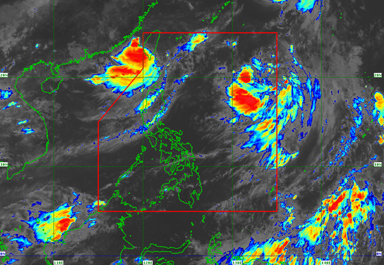
On Saturday afternoon (September 29, 2018), the Philippine Atmospheric, Geophysical and Astronomical Services Administration (PAGASA) reported that Typhoon Paeng (Trami) left the country.
However, Paeng was still affecting the coastal waters over northern and eastern Luzon making sea travel risky for fisher folks.
PAGASA is now closely monitoring a new tropical depression outside the Philippine Area of Responsibility (PAR), which was last spotted at 1,990 km east of Visayas.
The tropical depression has maximum sustained winds of 60 kilometers per hour (kph) and gustiness of up to 75 kph.
The weather disturbance was expected to enter PAR on Tuesday (October 2, 2018) with a possibility of developing into a typhoon.
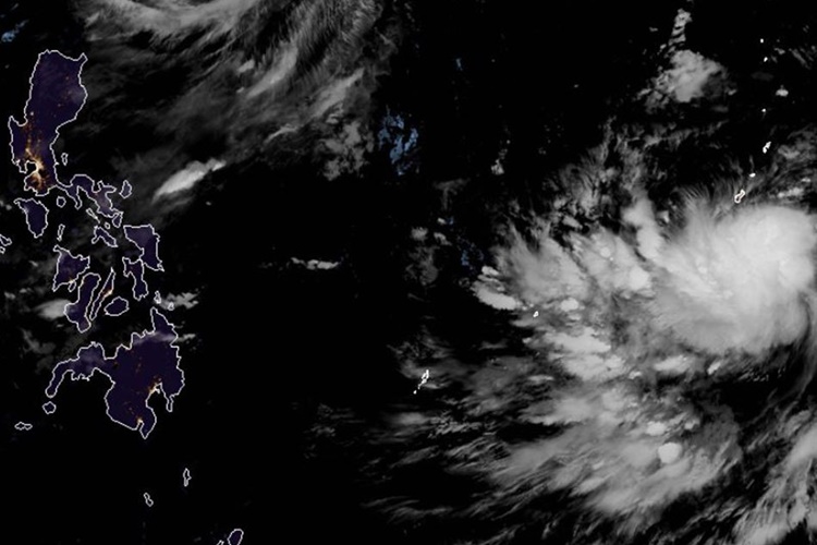
The depression will be named “Queenie”, the 17th cyclone to enter the country if it enters PAR next week.
The possible ‘Queenie’ is moving 45 kph at a west-northwest direction.
What can you say about this? Just feel free to leave your comments and reactions to this article.