Latest Update About Typhoon Paeng Released By PAGASA
The state weather bureau PAGASA has released the latest updates about Typhoon Paeng, which is now moving in the northwest direction.
On Friday (September 28, 2018), the Philippine Atmospheric, Geophysical and Astronomical Services Administration (PAGASA) reported the latest news about the weather disturbance.
PAGASA said that Typhoon Paeng keeps its strength after it was last spotted at 695 kilometers east northeast of Basco, Batanes.
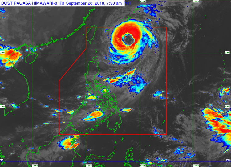
Paeng has maximum sustained winds of 160 kilometers per hour (kph) and gustiness of 195 kph.
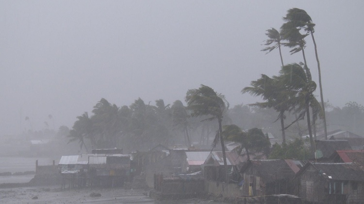
Localized thunderstorms would bring cloudy weather conditions and isolated rain showers over the Metro Manila and the rest of the country.
The weather agency also warned the residents in the affected areas to take precautionary measures for possible flashfloods and landslides because of the severe thunderstorms.
The typhoon was expected to leave the Philippine Area of Responsibility (PAR) on Saturday (September 29, 2018).
Meanwhile, Northern and eastern sections of Luzon and the eastern section of the Visayas would have rough to very rough water condition.
Mindanao would have moderate to rough waters while the rest of the country will experience slight to moderate coastal waters.
What can you say about the country’s weather condition? Just feel free to leave your comments and reactions to this article.