Typhoon Paeng Latest Updates Released By PAGASA
The state weather bureau PAGASA has released the latest updates regarding Typhoon Paeng affecting the country’s weather condition.
On Tuesday (September 25, 2018), the Philippine Atmospheric, Geophysical, and Astronomical Services Administration (PAGASA) released the latest weather updates in the country.
PAGASA reported that the trough or extension of Typhoon Paeng with an international name “Trami” would bring rains over some parts of the country.
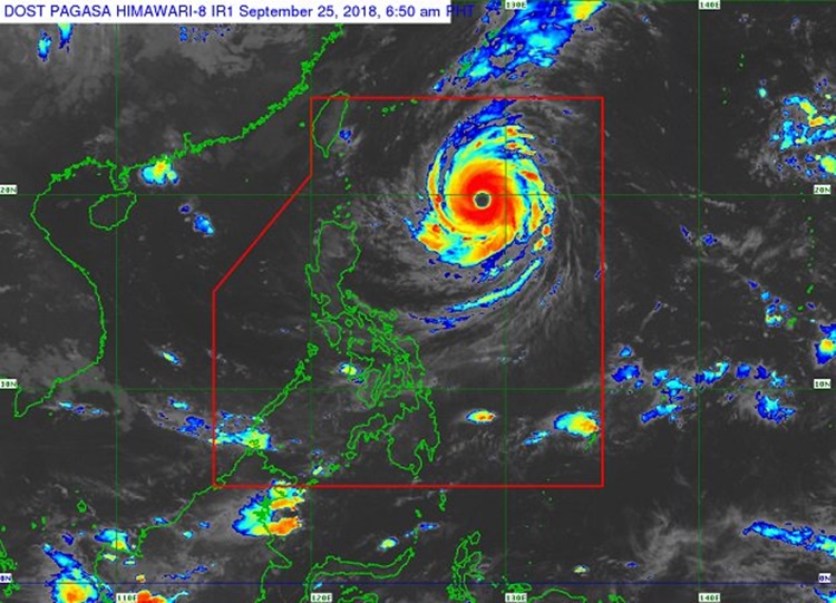
The weather disturbance was last spotted at 740 kilometers east of Basco, Batanes as it moves slower at 10 kph.
Paeng has maximum sustained winds of 200 kilometers per hour (kph) and gustiness of up to 240 kph.
The typhoon’s trough would bring light to heavy rains over Western Visayas, the Zamboanga Peninsula, Autonomous Region in Muslim Mindanao, and Soccsksargen.
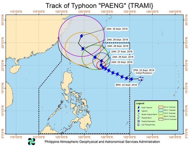
On Friday (September 28, 2018), Trami was expected to bring light to moderate rains over Northern Luzon
Localized thunderstorms would also affect the weather condition over the rest of the country.
The typhoon might leave the Philippine Area of Responsibility (PAR) on Saturday (September 29, 2018).
What can you say about this? Just feel free to leave your comments and reactions to this article.