Tropical Storm Basyang Latest Weather Update
The state weather agency PAGASA has released latest weather update regarding Tropical Storm Basyang on Tuesday (February 13, 2018).
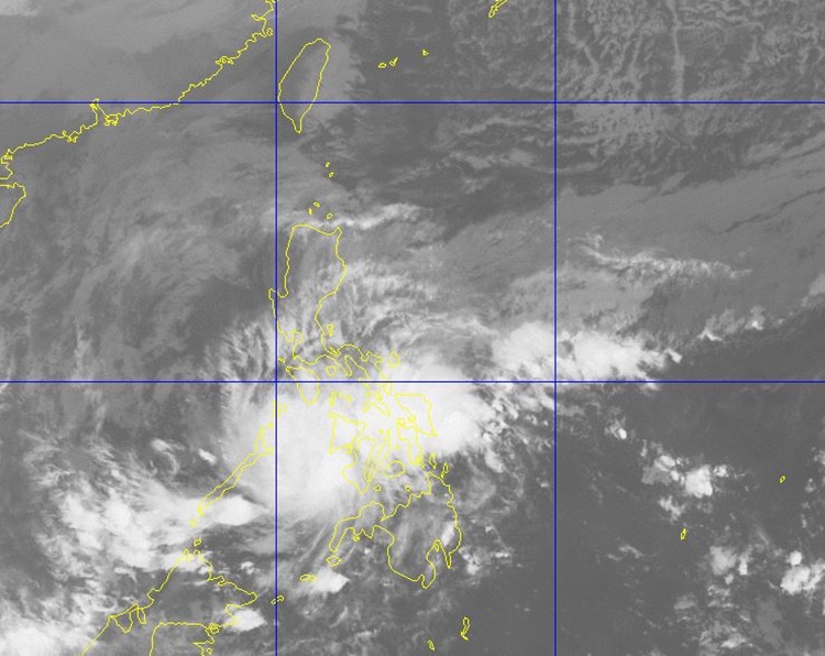
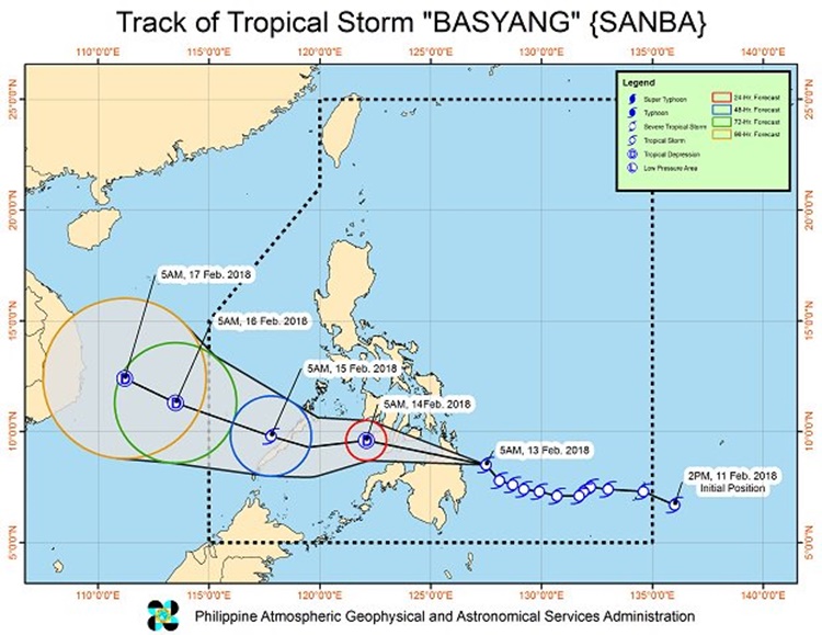
The Philippine Atmospheric, Geophysical and Astronomical Services Administration (PAGASA) reported that Tropical Storm Sanba or locally known as Bagyong Basyang maintained its strength as it nears landfall.
Basyang was expected to make a landfall between Surigao and Dinagat provinces after it was last spotted about 80 kilometers northeast of Hinatuan, Surigao del Sur.

The tropical storm has maximum sustained winds of 65 kilometers per hour (kph) and gustiness of up to 80 kph moving northwest at 25 kph.
PAGASA also raised tropical cyclone signal warnings in different parts of the country due to the inclement weather brought by the weather disturbance.
Signal No. 1
- Palawan
- Calamian Group of Islands
- Southern Section of Masbate
- Aklan
- Capiz
- Antique
- Iloilo
- Guimaras
- Negros Occidental
- Cebu
- Leyte,
- Biliran
- Samar
- Eastern Samar
Signal No. 2
- Bohol
- Southern Cebu
- Siquijor
- Negros Oriental
- Southern Negros Occidental
- Southern Leyte
- Dinagat Island
- Surigao del Norte
- Surigao del Sur
- Agusan del Norte
- Agusan del Sur
- Camiguin
- Misamis Oriental
- Northern Section of Bukidnon
Bagyong Basyang was also expected to make a landfall in Caraga Region this morning.

The weather agency also announced that scattered to widespread moderate to heavy rain would be experienced over Visayas and Mindanao in the next 24 hours.
The weather disturbance was expected to leave the Philippine Area of Responsibility (PAR) on Friday (February 16, 2018).
What can you say about this? Just feel free to leave your comments and reactions to this article.
You can also read #WalangPasok: Suspension Of Cl(–foul word(s) removed–) On Tuesday (February 13)
