According to the latest updates released by the USGS, Negros Province and the entire Negros island was hit a magnitude 6.8 Earthquake today, February 6 at 11:49 A.M.
Related Article: Bohol Earthquake 7.2 October 15, 2013
So far no casualties were reported but it was being felt most people including the writer of this post. It is felt by more than 30 seconds or longer.
USGS reported the 6.8 earthquake on its official website.
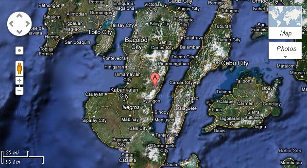
The earthquake in Bacolod was felt everywhere in the Negros Province. The epicenter was recorded at 71 km. SSE of Bacolod City.
The location of the earthquake is at 72 km (44 miles) North of Dumaguete; 74 km (45 miles) West North West of Tagbilaran, Bohol; 80 km (49 miles) West South West of Cebu.
Latest Update: Bacolod Earthquake as of November 14, 2012
The exact location is at 9.96 degrees North, 123.24 degrees East. It has a depth of 46.6 km. (29 miles).
Here is the map provided by GoogleMap estimated by USGS:


indeed nobody can predict what will happen, especially if it’s the mother nature behind it. thankful that my family and friends r all safe. friends let’s not never fail to pray. be ready with ur flashlights, matches, candles, whistle, or any other things that can help us in case of emergency esp. at night, jaz n case… God bless us all