PAGASA Releases Latest Weather Update for Friday (September 26, 2025)
PAGASA LATEST UPDATE – The state weather bureau reported that Typhoon Opong has weakened into a severe tropical storm.
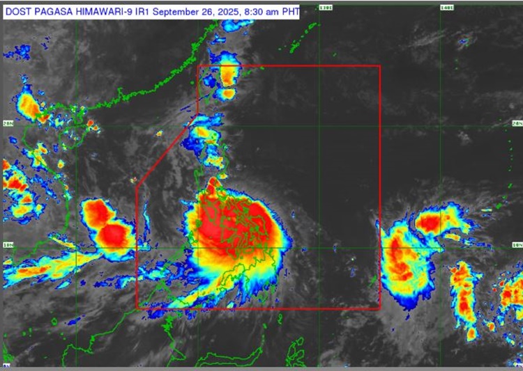
On Friday (September 26, 2025), the Philippine Atmospheric, Geophysical and Astronomical Services Administration released the latest weather update in the country. Typhoon Opong will continue to affect the country’s weather condition.
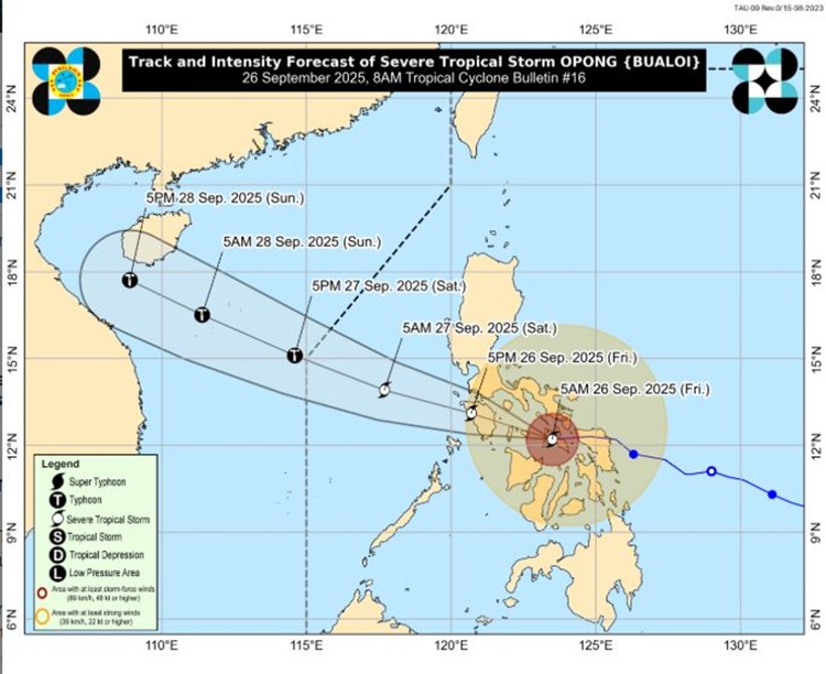
PAGASA reported that Typhoon Opong has weakened and has been classified as a severe tropical storm. It was last spotted in the vicinity of Dolores, Eastern Samar.
Opong packs maximum sustained winds of 10o kph near the center and a gustiness reaching up to 165 kph, moving west-northwest at 25 kph.
The weather agency raised tropical cyclone wind signals in the following areas:
Signal No. 3
- Sorsogon
- Masbate including Ticao and Burias Islands
- Albay
- the western and southern portions of Camarines Sur
- the southern portion of Quezon
- Marinduque
- Romblon
- Oriental Mindoro
- Occidental Mindoro including Lubang Islands
- Batangas
- the southern portion of Laguna
Visayas
- Northern Samar,
- the northern and central portions of Eastern Samar
- the northern and central portions of Samar
- Biliran
- and the northern portion of Leyte
Signal No. 2
Luzon
- Catanduanes
- the rest of Camarines Sur
- Camarines Norte
- the rest of Quezon
- the rest of Laguna
- Rizal
- Cavite
- Metro Manila
- Bulacan
- Pampanga
- Bataan
- the southern portion of Zambales
- Calamian Islands
Visayas
- The rest of Eastern Samar
- the rest of Samar
- the northern and central portions of Leyte
- the northern portion of Cebu, including Camotes and Bantayan Islands,
- the extreme northern portion of Negros Occidental
- the northern portion of Iloilo
- Capiz
- Aklan
- and the northwestern portion of Antique, including Caluya Islands
Signal No. 1
Luzon
- The central and southern portions of Isabela
- Quirino
- Nueva Vizcaya
- Ifugao
- the southwestern portion of Mountain Province (Bauko, Sabangan, Tadian)
- Benguet
- the southern portion of Ilocos Sur
- La Union
- Pangasinan
- Aurora
- Nueva Ecija
- Tarlac
- the rest of Zambales
- Cuyo Islands
- and the northern portion of mainland Palawan
Visayas
- Southern Leyte,
- the rest of Leyte,
- the eastern and central portions of Bohol
- the central portion of Cebu
- the northern portion of Negros Oriental
- the northern and central portions of Negros Occidental
- the central portion of Iloilo
- and the central portion of Antique
Mindanao
- Dinagat Islands and Surigao del Norte including Siargao Island and Bucas Grande Islands
Opong enhances that southwest monsoon, which will bring gale-force gusts across Ilocos Region, Cordillera Administrative Region, Cagayan Valley, Palawan, Visayas, Zamboanga del Norte, Misamis Occidental, Misamis Oriental, Camiguin, Caraga Region, and Davao Region.
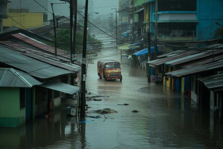
The weather agency also warned the public for possible flash floods or landslides due to moderate to heavy rains and severe thunderstorms.
The severe tropical storm will traverse Masbate, Sibuyan Sea, southern Calabarzon, and northern Mimaropa, before emerging over the West Philippine Sea between late Friday and Saturday (September 27).
RELATED ARTICLE: Typhoon Opong Update: Wind Signal No. 3 Is Up Over these Areas as Storm Hits Masbate