PAGASA Releases Latest Weather Update for Thursday (September 25, 2025)
PAGASA LATEST UPDATE – The state weather bureau reported that Severe Tropical Storm Opong continues to intensify.
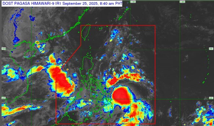
On Thursday (September 25, 2025), the Philippine Atmospheric, Geophysical and Astronomical Services Administration released the latest weather update in the country. Severe Tropical Storm Opong will affect the country’s weather condition.
PAGASA reported that Opong was last spotted 440 kilometers east of Guiuan, Eastern Samar. It packs maximum sustained winds of 110 kilometers per hour and gustiness of up to 135 kph.

Opong will continue to intensify while over the Philippine Sea and may reach typhoon category before making landfall over Bicol Region. It is expected to weaken as it crosses the archipelago.
“It will then weaken as it crosses the archipelago, although it will likely remain as a typhoon or severe tropical storm during the passage. Re-intensification is highly likely once Opong emerges over the West Philippine Sea,” PAGASA said.
Tropical Cyclone Wind Signals were raised in the following areas:
TCWS No. 2
- Catanduanes
- The southern portion of Albay
- Sorsogon
- Northern Samar
- The northern and central portions of Eastern Samar
- The northern and central portions of Samar
TCWS No. 1
- The rest of Albay
- Masbate, including Ticao Island and Burias Island
- Camarines Sur
- Camarines Norte
- Marinduque
- Romblon
- Oriental Mindoro
- Occidental Mindoro, including the Lubang Islands
- Quezon, including Polillo Islands
- Rizal
- Laguna
- Batangas
- Cavite
- Aurora
- Metro Manila
- Bulacan
- Nueva Ecija
- Tarlac
- Pampanga
- Zambales
- Bataan
- The central and southern portions of Isabela
- Quirino
- Nueva Vizcaya
- Ifugao
- The southwestern portion of Mountain Province (Bauko, Sabangan, Tadian)
- Benguet
- The southern portion of Ilocos Sur (Sugpon, Alilem)
- La Union
- Pangasinan
- The rest of Eastern Samar and the rest of Samar
- Biliran
- Leyte
- Southern Leyte
- The northern portion of Cebu, including Camotes Island and Bantayan Island
- The northern portion of Negros Occidental
- The northern portion of Iloilo
- Capiz
- Aklan
- The northern and central portions of Antique, including Caluya Islands and Calamian Islands
- Mindanao
- Siargao Island, Bucas Grande Island, and Dinagat Island
The severe tropical storm will bring stormy weather conditions over Catanduanes, Sorsogon, Eastern Samar, Northern Samar, and Samar.
Rains with gusty winds are expected over the rest of Bicol Region, Quezon including Polillo Islands, Rizal, Laguna, Batangas, Marinduque, Oriental Mindoro, Romblon, Aklan, Capiz, Biliran, Leyte, Southern Leyte, Dinagat Islands, and Surigao del Norte.
The southwest monsoon will bring cloudy skies with scattered rains and thunderstorms over Metro Manila, rest of Western Visayas, Negros Island Region, rest of Central Luzon, Zamboanga Peninsula, Northern Mindanao, Palawan, and Cavite.
Habagat will also bring partly cloudy to cloudy skies with isolated rainshowers or thunderstorms over the rest of Mindanao, according to PAGASA.
RELATED ARTICLE: Tropical Storm Opong May Cause Widespread Flooding Over Luzon This Week