PAGASA Says LPA to Affect PH Weather Condition
PAGASA LATEST UPDATE – The state weather bureau reported that a low-pressure area will bring rain over parts of the country.
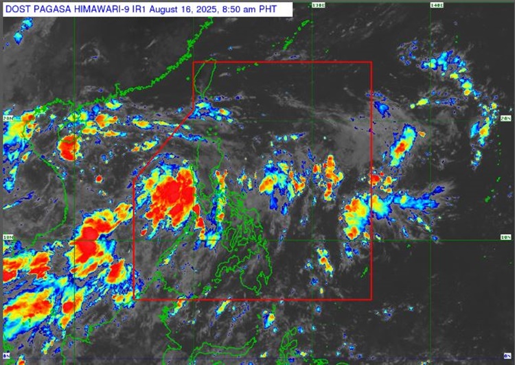
On Saturday (August 16, 2025), the Philippine Atmospheric, Geophysical ,and Astronomical Services Administration released the latest weather update in the country. A low-pressure area will affect the country’s weather conditions.
PAGASA specialist Grace Castañeda reported that the low-pressure area has a slim chance of developing into a tropical cyclone within the next 24 hours. It will affect Northern and Central Luzon.
“We do not see this entering the PAR. Generally, its movement will be west-northwestward or northwestward, away from any part of our landmass,” Castañeda said.
The low-pressure area was last spotted at 640 km west of Iba, Zambales. The LPA will bring cloudy skies with scattered rains and thunderstorms over Ilocos Region, Cordillera Administrative Region, Central Luzon, Batanes, and Babuyan Islands.
“But its trough or extension, today until tomorrow, will still cause rains in much of Northern and Central Luzon,” she added.
The southwest monsoon will bring similar weather conditions over Metro Manila, Visayas, CALABARZON, MIMAROPA, and the Bicol Region.
The localized thunderstorms are expected over the remaining parts of the country.
A cloudy cluster is being monitored east of the country. “If it develops circulation, it could affect the eastern part of Northern Luzon as well as Extreme Northern Luzon by early next week,” Castañeda explained.
The weather agency has advised the residents in the affected areas to take precautionary measures for possible flash floods or landslides due to moderate to at times heavy rains.
The coastal water condition over the northern and western sections of Luzon will be moderate. The rest of the country will be slight to moderate, according to PAGASA.
RELATED ARTICLE: PAGASA Releases Latest Weather Update for Friday (August 15, 2025)