PAGASA Says 2 Weather Systems to Affect PH Weather Condition
PAGASA LATEST UPDATE – The state weather bureau reported that LPA’s trough and habagat will bring rains over parts of the country.
On Monday (June 30, 2025), the Philippine Atmospheric, Geophysical and Astronomical Services Administration released the latest weather update in the country. The low-pressure area’s trough and the southwest monsoon will affect the country’s weather conditions.
PAGASA weather specialist Daniel James Villamil said that the trough or extension of a low-pressure area and the Southwest Monsoon will bring rains over several areas.

“For now, the low-pressure area has a low probability of becoming a tropical cyclone in the next 24 hours,” Villamil said.
The trough of the LPA will bring cloudy skies with scattered rains and thunderstorms over Bicol Region, Eastern Visayas, Aurora, and Quezon.
“In our satellite image, we can see thick cloud clusters here in most parts of the country,” Villamil said.
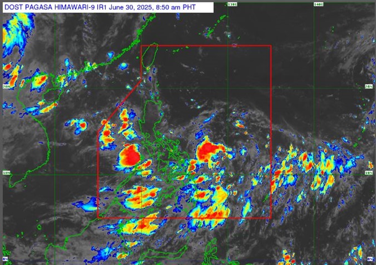
The LPA was last spotted 1,230 km east of Central Luzon. It will bring Metro Manila, Mindanao, MIMAROPA, and the rest of Central Luzon, CALABARZON, and Visayas.
The localized thunderstorms will bring partly cloudy to cloudy skies with isolated rain showers or thunderstorms over the rest of Luzon. Habagat will bring similar weather conditions over the remaining parts of the country.
The weather agency has advised the residents in the affected areas to take precautionary measures for possible flash floods or landslides due to moderate to at times heavy rains and severe thunderstorms.
Meanwhile, the coastal water conditions throughout the country will be slight to moderate, according to PAGASA.
No gale warning was raised over any of the country’s seaboard.
This is a developing report, just visit this website or refresh the page for further updates.
RELATED ARTICLE: PAGASA Releases Latest Weather Update for Saturday (June 28, 2025)