PAGASA Releases Latest Weather Update for Monday (May 22, 2023)
The state weather bureau PAGASA reported possible super typhoon Mawar may enter the country’s vicinity this week.
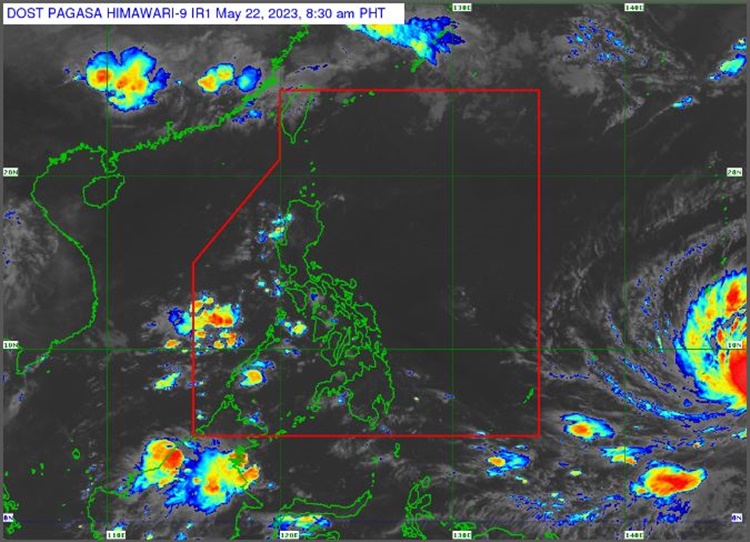
On Monday (May 22, 2023), the Philippine Atmospheric, Geophysical and Astronomical Services Administration released the latest weather update in the country. Typhoon Mawar may enter the Philippine Area of Responsibility by Friday (May 26, 2023).
Pagasa weather specialist Obet Badrina reported that Typhoon Mawar was last spotted 2,330 kilometers east of Mindanao. “Itong binabantayan natin na si Bagyong Mawar, maaari itong maging isang super typhoon lalo na at nasa karagatan ito,” Badrina said.

Mawar is moving northwestward and may bring rains during the weekend. “Inaasahan na ito ay kikilos pa-hilagang-kanluran at possibile itong pumasok ng PAR bandang araw ng Biyernes,” he said.
The typhoon will be named “Betty” once it enters the country’s vicinity. The weather disturbance would be the second storm to enter PAR this year.
PAGASA reported that Southwesterly Windflow. The rest of Visayas will bring cloudy weather condition with scattered rainshowers and thunderstorms over Antique, Palawan, including Kalayaan Islands, Occidental Mindoro.

The Southwesterly Windflow / Localized Thunderstorms and the localized thunderstorms will bring partly cloudy to cloudy skies with isolated rainshowers or thunderstorms over the rest of Visayas.
The weather agency has warned the public for possible flash floods and landslides during severe thunderstorms.
Meanwhile, the coastal water condition over Luzon, Visayas and Mindanao will be slight to moderate, according to the weather bureau.
What can you say about the latest weather update? Just feel free to leave your comments and reactions to this article.
Thank you for visiting Philippine Trending News (Philnews.ph). You may also follow us on the following social media platforms; Facebook, Twitter, and YouTube
Read Also: PAGASA: Possible Super Typhoon Mawar May Enter PAR on Friday
