Another LPA Spotted In Mindanao & Expected To Turn Into Storm, PAGASA Says
The state weather bureau PAGASA announces that another Low-Pressure Area (LPA) was spotted in Mindanao and expected to intensify into a storm.
On Monday (November 12, 2018), the Philippine Atmospheric, Geophysical and Astronomical Services Administration (PAGASA) released the latest weather update in the country.
PAGASA reported that another LPA was spotted at 405 kilometers east of Hinatuan, Surigao expected to bring rains over Mindanao.
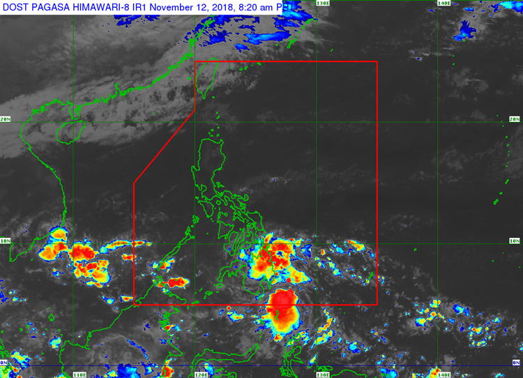
The weather agency said that the weather disturbance may intensify into a tropical depression after crossing the Sulu Sea on Thursday (November 15, 2018).
The low-pressure area will be given a local name “Samuel” after it develops into a storm and becomes the 19th tropical cyclone to hit the country this 2018.
PAGASA weather forecaster Ariel Rojas also said that the tail end of a cold front would bring scattered and occasionally severe rains.
Rojas warned that the severe rains might cause flash floods and landslides over Bicol Region and Palawan.
Meanwhile, the rest of Luzon would have fair weather condition due to the northeast monsoon “Amihan”.
What can you say about this? Just feel free to leave your comments and reactions to this article.