Latest Updates About Typhoon Queenie Released By PAGASA
The state weather bureau PAGASA has released the latest updates about Typhoon Queenie bringing inclement weather condition over some parts of the country.
On Wednesday (October 3, 2018), the Philippine Atmospheric, Geophysical and Astronomical Services Administration (PAGASA) released the newest updates about Typhoon Queenie.
PAGASA reported that Typhoon Kong-Rey (Queenie) was last spotted at 875 kilometers east of Basco, Batanes.

Typhoon Queenie has maximum sustained winds of 200 kilometers per hour (kph) and gustiness of up 245 kph moving 20 kph at a northwest direction.
The trough or extension of Queenie was expected to bring scattered rainshowers over some parts of the Visayas and Mindanao.
Meanwhile, Metro Manila and the rest of the country would have cloudy weather conditions with isolated rainshowers due to localized thunderstorms.

The weather disturbance was not expected to make a landfall in any parts of the country and no tropical cyclone warning signals have been raised.
However, the weather agency advised the residents in the affected areas to take precautionary measures for possible flashfloods and landslides.
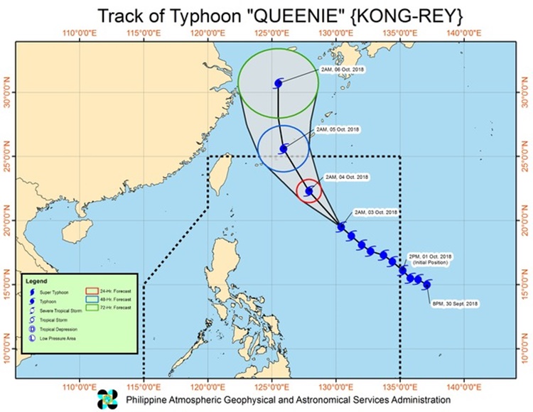
Queenie was expected to leave the Philippine Area of Responsibility (PAR) on Friday morning (October 5, 2018).
What can you say about this? Just feel free to leave your comments and reactions to this article.