Latest Updates On Typhoon Paeng Released By PAGASA
The state weather bureau PAGASA has released the recent and latest updates about Typhoon Paeng, which is now traveling across PAR.
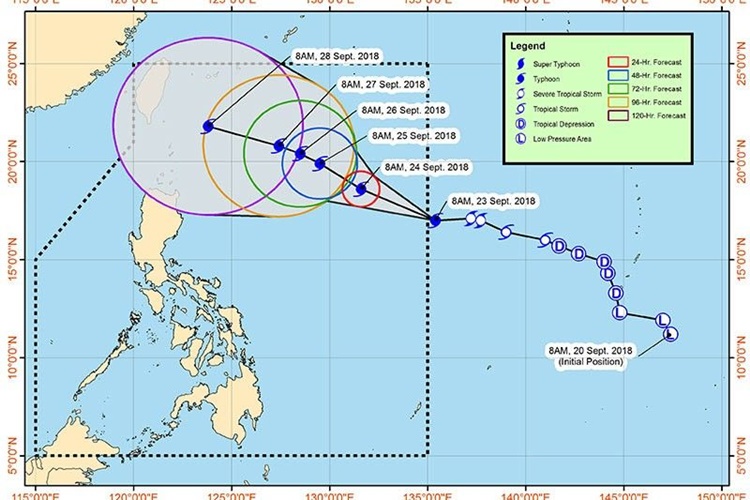
On Thursday (September 27, 2018), the Philippine Atmospheric, Geophysical and Astronomical Services Administration (PAGASA) released the newest news about Typhoon Trami or locally known as “Paeng”.
Paeng is expected to speed up until it leaves the Philippine Area of Responsibility (PAR) on Saturday afternoon (September 27, 2018).
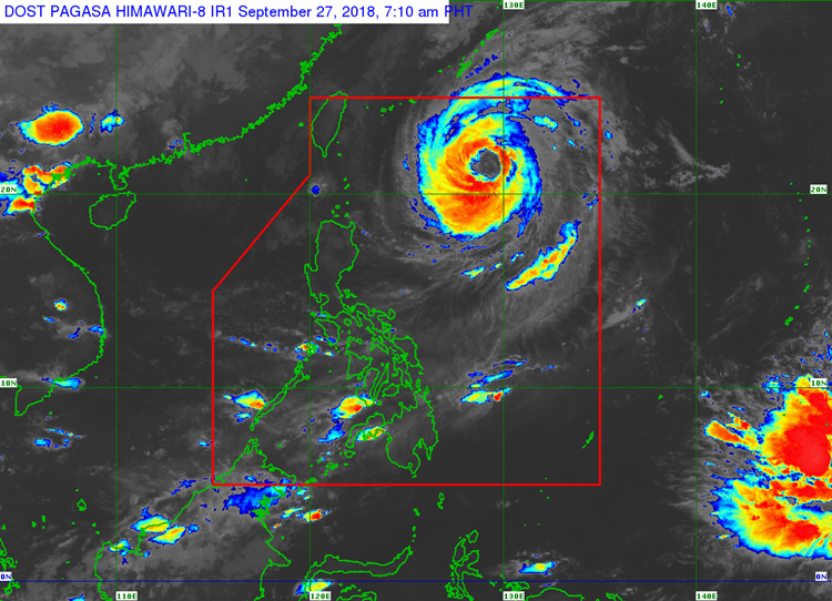
The typhoon was last spotted at 750 kilometers east of Basco, Batanes packing maximum sustained winds of 160 kilometers per hour (kph) and gustiness of up to 195 kph.
The weather disturbance would bring cloudy skies with scattered rains and thunderstorms over Zamboanga Peninsula, Northern Mindanao, and Caraga region.
Localized thunderstorms would be also experienced in Metro Manila and the rest of the country.
Meanwhile, another low-pressure area located at 3,100 km east southeast of Mindanao, according to the weather agency.
PAGASA predicted that the LPA might intensify into a typhoon and enter the country’s vicinity next week.
What can you say about this? Just feel free to leave your comments and reactions to this article.