PAGASA Releases Latest Update About Typhoon Gardo (Maria)
The Philippine weather agency PAGASA has released the latest update regarding Typhoon Gardo (Maria), which was expected to enter PAR on Monday.
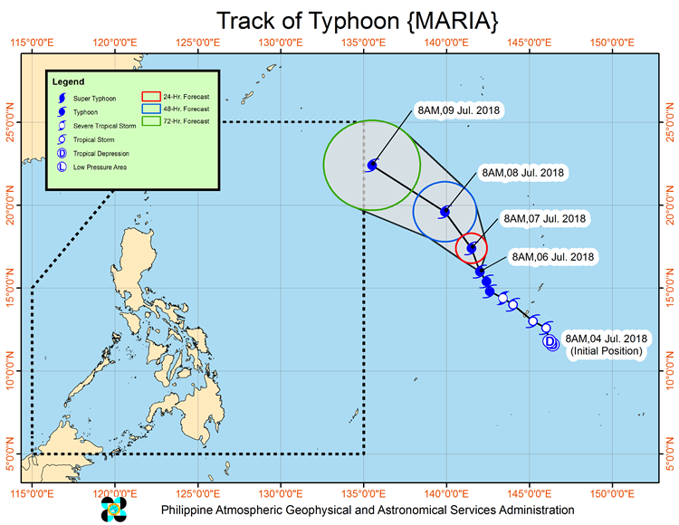
On Saturday (July 07, 2018), the Philippine Atmospheric, Geophysical and Astronomical Services Administration (PAGASA) announced that Bagyong Gardo with an international name of Maria keeps its strength and might enhance “habagat”.
Gardo was last spotted at 1,995 kilometers east of Central Luzon packing maximum sustained winds of 185 kilometers per hour (kph) and gustiness of up to 225 kph moving 15 kph at northwest direction.

The weather disturbance was expected to enter the Philippine Area of Responsibility (PAR) on Monday (July 09, 2018).
The typhoon is forecast to be 1,875 km east of Northern Luzon on Sunday morning (July 08, 2018).
PAGASA also said that the typhoon is not expected to make a landfall but might enhance the southwest monsoon.
The enhanced “Habagat” will bring occasional rain over Metro Manila, Western Visayas and the western sections of Calabarzon and Mimaropa during the weekend.
The residents living in the affected areas were advised to be alert and prepared for possible flashfloods and landslides.
What can you say about this? Just feel free to leave your comments and reactions to this article.
You can also read Typhoon Maria To Enter PAR Next Week, Expected To Intensify As Super Typhoon