Typhoon Maria To Enter PAR Next Week, Expected To Intensify As Super Typhoon
The state weather bureau PAGASA has announced that Typhoon Maria will enter the PAR by next week and expected to turn into a super typhoon.
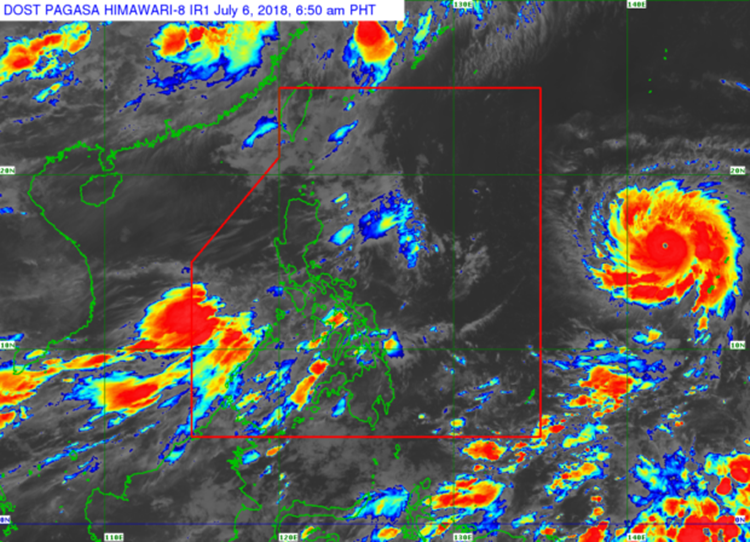
On Friday (July 06, 2018), the Philippine Atmospheric Geophysical and Astronomical Services Administration (PAGASA) reported that a typhoon was expected to affect the country’s weather system next week.
Weather forecaster Ezra Bulquerin said that ‘Maria’ will not make a landfall but could enhance the southwest bringing moderate to heavy rain over the western part of Luzon and Visayas.
The weather disturbance will be named “Gardo” after entering the Philippine Area of Responsibility (PAR).
The typhoon was last spotted 1,965 kilometers east of Southern Luzon with maximum sustained winds of 12k kilometers per hour (kph) and gustiness of up to 155 kph moving 10 kph at north-northwest direction.
Southwest monsoon would still affect the western sections of Luzon and Visayas.

Cloudy skies with rain and thunderstorms over Western Visayas, Zamboanga Peninsula along with the provinces of Palawan and Mindoro.
Meanwhile, Metro Manila and the rest of the country would have cloudy skies with isolated rain and thunderstorms.
PAGASA also expected Maria to develop into a ‘Super Typhoon’ packing sustained winds of 245 kph and gustiness of up to 290 kph.
What can you say about this? Just feel free to leave your comments and reactions to this article.