Weather Disturbance Spotted Near PAR, PAGASA Says
The state weather bureau PAGASA is now closely monitoring a weather disturbance near the Philippine Area of Responsibility (PAR).
On Wednesday (July 04, 2018), the Philippine Atmospheric, Geophysical and Astronomical Services Administration (PAGASA) released the latest weather condition affecting the country’s weather system.
PAGASA said that the tropical cyclone might break into the PAR after it was spotted at 2,300 km east of Visayas.
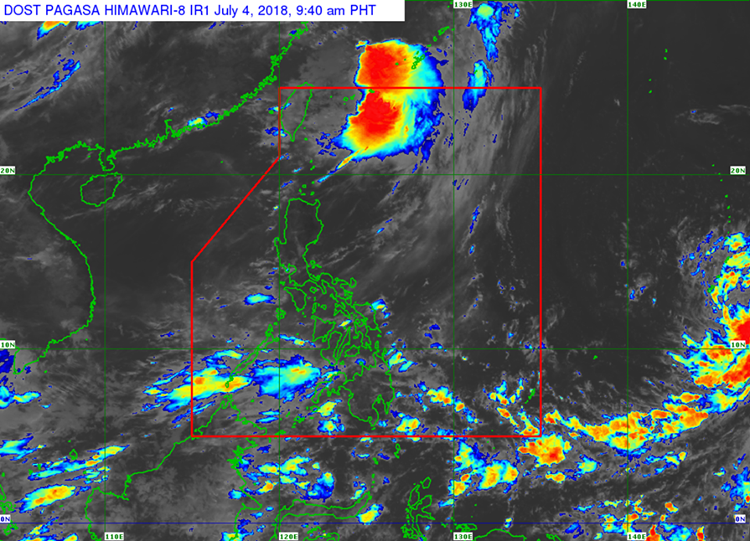
However, the chance of the weather disturbance to make a landfall in the country is very low.
The weather agency also announced that southwest monsoon will still bring heavy rains over the provinces of Palawan, Mindoro, and Visayas.
The residents in the affected areas were advised to take precautionary measures for possible flashfloods and landslides.

Meanwhile, localized thunderstorms are expected over Metro Manila and the rest of the country.
The GMA meteorologist Nathaniel Cruz said the tropical depression will be named “Bagyong Gardo” if it breaks into the Philippine Area of Responsibility next week.
What can you say about this? Just feel free to leave your comments and reactions to this article.