Tropical Cyclone Hagupit (Bagyong Ruby) entered the Philippine Area of Responsibility at around 3:00 AM on Thursday, December 4, 2014 with an increased speed according to the latest weather updates released by the country’s weather bureau, PAGASA.
See Also: Bagyong Hagupit December 4, 2014 Hourly Update

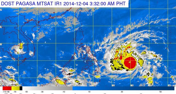
According to PAGASA, Bagyong Hagupit was last spotted at 942 km east northeast of Hinatuan, Surigao del Sur or 1,023 km east of Surigao City. It is packing maximum sustained winds of 175 kilometers per hour (kph) near the center and gustiness of up to 210 kph.
The weather disturbance is forecast to move west northwest at 25 kph, PAGASA also confirmed that right now there is a 75% chance that it will hit land, and 25% of it changing track.
PAGASA forecaster Samuel Duran stated that effects of typhoon Hagupit (Bagyong Ruby) will be felt in the country starting on Friday, the weather bureau is also monitoring the situation in case storm signals need to be raised in critical areas.
The national government through the National Disaster Risk Reduction and Management Council and PAGASA stated that more than 44 provinces have been declared as critical areas when the Hagupit make a landfall in the country. These provinces are expected to experience heavy to intense rains and strong winds from 95 to 110 kph.