The Tropical Storm Henry (international name Matmo) already enters the Philippine Area of Responsibility according to PAGASA on Friday morning. Based upon the latest weather bulletin released by PAGASA, the eye of the typhoon was located at 890 kilometers east of Guiuan, Eastern Samar at around 7:00 AM. PAGASA released the expected track of Bagyong Henry and forecasts that it will not make a landfall in the Philippines.
Here’s the Typhoon Track of Bagyong Henry:
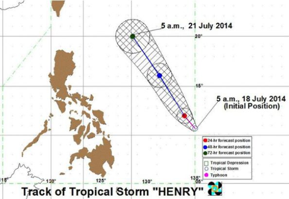
Bagyong Henry has packed a maximum sustained winds of 65 kilometers per hour (kph) near the center and gusts of up to 80 kph. PAGASA forecasts that the newest typhoon that enters PAR will move north northwest at 7 kph, it is expected to be at 800 kilometers east of Guiuan, Eastern Samar by tomorrow morning.
The Tropical Storm will be at 860 kilometers east of Casiguran, Aurora by Sunday morning and by Monday morning, July 21, 2014, Bagyong Henry would be at 600 kilometers east of Basco, Batanes.
PAGASA noted further that moderate to heavy rainfall (7.5 – 15 mm per hour) has been estimated within the 400-kilometer diameter of the tropical storm. The Tropical Storm will not affect any part of the country according to PAGASA’s latest weather bulletin.