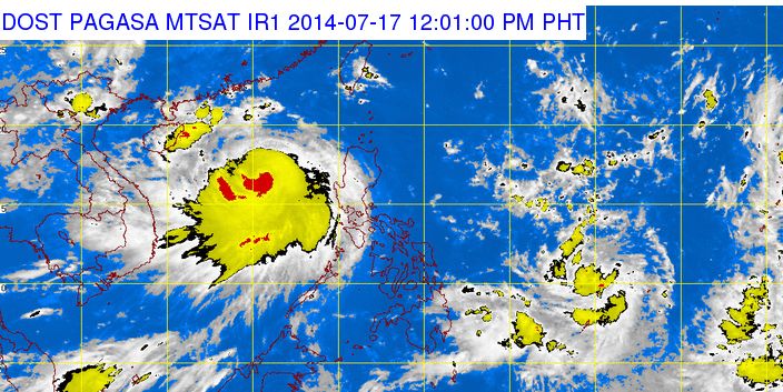
The Philippine Atmospheric Geophysical and Astronomical Services Administration (PAGASA) announced on Thursday, July 17, 2014 that a potential cyclone is expected to enter the Philippine Area of Responsibility (PAR) in the next 24 hours. The Low Pressure Area (LAP) was spotted at 940 kilometers east of Northern Mindanao as of 4:00 AM.
See Also: Bagyong Henry to Enter PAR on Friday, July 18, 2014
The LPA that will enter the Philippines after Bagyong Glenda will be locally code-named “Henry” once the LPA intensifies into a cyclone within the Philippine Area of Responsibility.
According to weather forecaster Glaiza Escullar, PAGASA has no data yet on the possible track of the typhoon, but the US Joint Warning Center (JTWC) stated already that the LPA was moving westwart at 2 knots (3.7 kilometers per hour).
Based upon the data gathered by JTWC, the LPA was approximately 205 nautical miles (379.66 kilometers) northeast of Koror, Palau.
The island of Koror, in Palau is the former capital of the Republic of Palau, the island comprised at least 70% of the country’s population which was recorded at 14,000 during the 2004 census.
Meanwhile, the Philippine weather bureau, PAGASA, noted that Metro Manila, Central Luzon, CALABARZON and the provinces of Mindoro, Palawan, La Union, Benguet and Pangasinan will have occasional rains after typhoon Glenda left Luzon with at least 20 people dead.
Bagyong Glenda was spotted at 380 kilometers west southwest of Dagupan City and is expected to exit the Philippine Area of Responsibility on Thursday morning.