Super Typhoon Yolanda’s Pie Image Captured Via Satellite Protecting Part of Negros Occidental
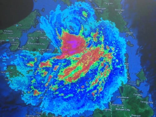
Super Typhoon Yolanda’s pie image on the map captured via satellite, shows an unusual happening. Yolanda is considered as the World’s strongest typhoon that struck the Philippine Area of Responsibility (PAR) last Friday November 8,2013. This tremendous disaster brought a lot of destruction in the infrastructures, agriculture and even kill the lives of many people … Read more