PAGASA Releases Update on Tropical Depression Wilma
PAGASA LATEST UPDATE – The state weather bureau reported that signal no. 1 was raised in 18 areas due to Tropical Depression Wilma.
On Friday (December 5, 2025), the Philippine Atmospheric, Geophysical and Astronomical Services Administration released the latest weather update in the country. Tropical Depression Wilma will affect the country’s weather condition.
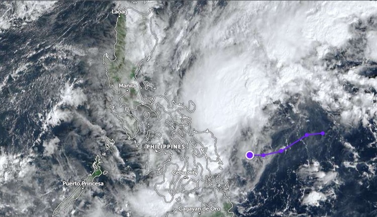
PAGASA reported that was last spotted 245 kilometers east of Borongan City, Eastern Samar. It packs maximum sustained winds of 45 kilometers per hour. It moves 20 kph at a west southwestward direction.
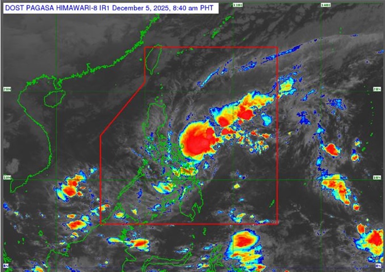
Wilma will bring rains with gusty winds over Eastern Visayas, Surigao del Norte, Surigao del Sur, and Dinagat Islands. It will also bring cloudy skies with scattered rains and thunderstorms over Northern Mindanao, Zamboanga Peninsula, the rest of Visayas, and the rest of Caraga.
Here is the list of areas under Signal No. 1:
Luzon
- Southern portion of mainland Masbate (Cataingan, Pio V. Corpuz, Esperanza, Placer, Cawayan, Palanas, Dimasalang)
Visayas
- Northern Samar
- Eastern Samar
- Samar
- Biliran
- Leyte
- Southern Leyte
- Northern and central portions of Cebu (Daanbantayan, Medellin, City of Bogo, San Remigio, Tabogon, Borbon, Tabuelan, Tuburan, Sogod, Catmon, Asturias, Carmen, Danao City, Balamban, Compostela, Liloan, Consolacion, Cebu City, Mandaue City, Cordova, Lapu-Lapu City, Toledo City, Pinamungahan, San Fernando, City of Naga, Minglanilla, City of Talisay, Aloguinsan, City of Carcar, Sibonga, Barili, Alcantara, Ronda, Dumanjug, Argao, Moalboal, Badian, Dalaguete, Alcoy) including Bantayan and Camotes Islands
- Bohol
- Northern and eastern portions of Negros Occidental (Sagay City, City of Escalante, Toboso, Calatrava, Enrique B. Magalona, City of Victorias, Manapla, Cadiz City, Bacolod City, City of Talisay, Silay City, Salvador Benedicto, San Carlos City, Murcia, Bago City, La Carlota City, La Castellana, Moises Padilla)
- Northern portion of Negros Oriental (City of Guihulngan, Canlaon City, Vallehermoso, La Libertad)
- Eastern portion of Iloilo (San Dionisio, Estancia, Batad, Carles, Concepcion, Ajuy, Sara, Balasan, Lemery, Barotac Viejo, San Rafael)
- Eastern portion of Capiz (Pilar, President Roxas)
Mindanao
- Surigao del Norte including Siargao and Bucas Grande Islands
- Dinagat Islands
- Northern portion of Surigao del Sur (Carrascal, Cantilan, Madrid, Carmen, Lanuza)
- Northern portion of Agusan del Norte (Kitcharao, Jabonga, Santiago, Tubay, City of Cabadbaran, Remedios T. Romualdez, Magallanes)
- Camiguin
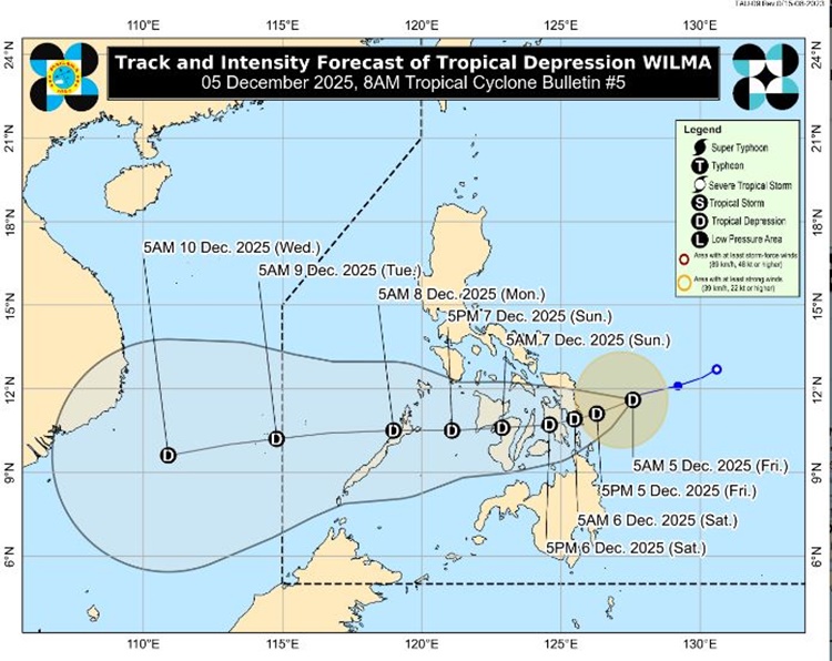
The weather disturbance is expected to west-southwestward until December 6, 2025.
“On the forecast track, Wilma’s center may make its initial landfall or pass close to eastern Visayas or the Dinagat Islands between this evening (December 5) and tomorrow morning (December 6). It will then continue across Visayas until Sunday (December 7), before emerging over the Sulu Sea and possibly passing over northern Palawan by Monday (December 8) morning,” Pagasa said.
The coastal water conditioning over Northern Luzon and the eastern sections of Central and Southern Luzon will be rough to very rough. The western section of Mindanao, the rest of Luzon, the rest of Visayas, and the rest of Mindanao will have moderate to rough waters, according to PAGASA.
RELATED ARTICLE: PAGASA: LPA Intensifies Into Tropical Depression Wilma