PAGASA Releases Latest Update About Severe Tropical Storm Tino
PAGASA LATEST UPDATE – The state weather bureau reported that Severe Tropical Storm Tino may become a Super Typhoon.
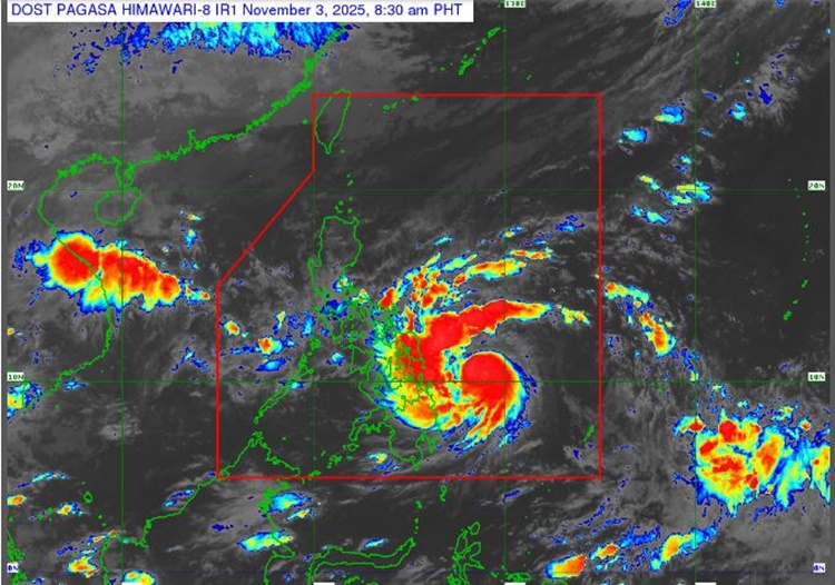
On Monday (November 3, 2025), the Philippine Atmospheric, Geophysical and Astronomical Services Administration released the latest weather update in the country. Severe Tropical Storm Tino will affect the country’s weather conditions.
PAGASA reported that Tino was last spotted 430 kilometers east of Guiuan, Eastern Samar with a maximum sustained wind speed of 110 kilometers per hour and a gustiness of up to 135 kph.
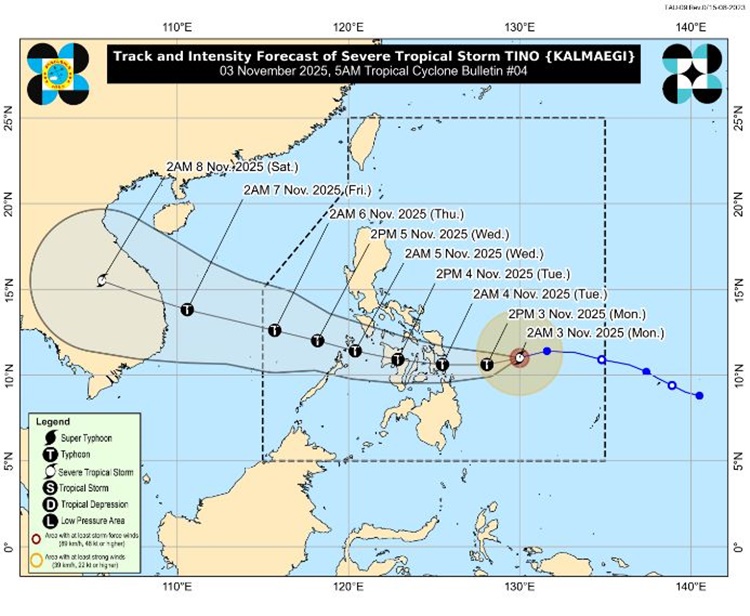
The tropical cyclone is expected to reach the typhoon category on Monday as it is expected to make its initial landfall over Eastern Samar, Leyte, or Dinagat Islands.
“The possibility of reaching super typhoon category is not ruled out based on alternate scenarios and climatological data. While its interaction with the terrain will trigger a slight weakening, Tino is expected to remain as a typhoon throughout its passage over the country,” PAGASA said.
Tropical cyclone wind signals are raised in the following areas:
Signal No. 2
VISAYAS
- Central and southern portions of Eastern Samar
- Central and southern portions of Samar
- Leyte
- Biliran
- Southern Leyte
- Camotes Islands
- The eastern portion of Bohol
Signal No. 1
Luzon
- Sorsogon
- Masbate including Ticao Island and Burias Island
- The southern portion of Albay
- The southern portion of Oriental Mindoro
- The southern portion of Occidental Mindoro
- Cuyo Islands
Visayas
- Northern Samar
- The rest of Eastern Samar
- The rest of Samar
- The rest of Bohol
- The rest of Cebu including Bantayan Islands
- Siquijor
- Negros Oriental
- Negros Occidental
- Guimaras
- Iloilo
- Capiz
- Aklan
- Antique including Caluya Islands
Mindanao
- The central portion of Surigao del Sur
- The northern portion of Agusan del Sur
- The rest of Agusan del Norte
- The eastern portion of Misamis Oriental
- Camiguin
The northeast monsoon will bring cloudy weather condition and rains over Ilocos Region, Cordillera Administrative Region and the rest of Cagayan Valley.
The shear line will be affecting the eastern sections of Northern and Central Luzon, while the localized thunderstorms will bring partly cloudy to cloudy skies with isolated rainshowers or thunderstorms over Metro Manila and the rest of the country, according to PAGASA.