
PAGASA Releases Latest Weather Update About Typhoon Saudel
PAGASA LATEST UPDATE – Typhoon Saudel is set to enter the Philippine Area of Responsibility on Monday (August 24, 2026).
On Monday (August 24, 2026), the Philippine Atmospheric, Geophysical, and Astronomical Services Administration released the latest weather update in the country. Typhoon Saudel may become a super typhoon.
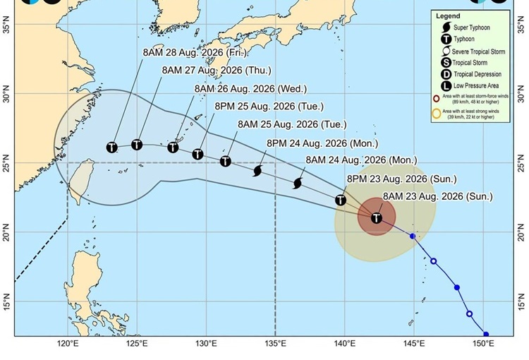
PAGASA weather specialist Aldczar Aurelio reported that Saudel was spotted at 1,660 kilometers east northeast of extreme Northern Luzon. It has maximum sustained winds of 175 kilometers per hour and gustiness of up to 215 kph.
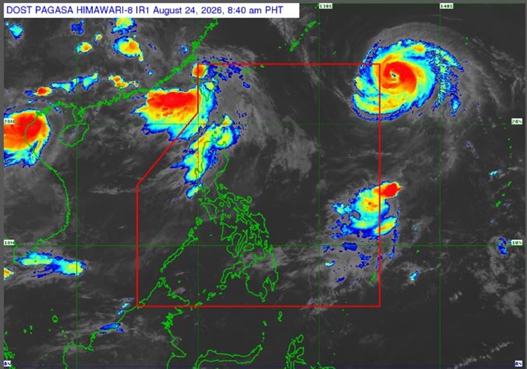
The typhoon is expected to enter the country’s vicinity on Monday morning or afternoon. It will be named ‘Obet’ once it enters PAR. Saudel will exit PAR on Tuesday (August 25).
“Ang bagyong may international name na Saudel ay inaasahang pumasok ng Philippine area of responsibility ngayong umaga o hapon, Base sa forecast track, ito ay inaasahang maging super typhoon kapag nasa loob ng Philippine Area of Responsibility,” Aurelio said.
Meanwhile, the southwest monsoon will bring cloudy skies with scattered rains and thunderstorms over Metro Manila, Ilocos Region, Cordillera Administrative Region, Central Luzon, the rest of Cagayan Valley, Cavite, Batangas, and Rizal.
Former Tropical Depression Neneng packing maximum wind speed of 55 kph and gustiness of up to 70 kph is being monitored outside PAR. It has a low chance of re-entering PAR.
The localized thunderstorms will bring partly cloudy to cloudy skies with isolated rain showers or thunderstorms over the remaining parts of the country.
The coastal water conditions over the northern and western sections of Luzon will be moderate to rough. The rest of the country will have slight to moderate surrounding sea conditions, according to PAGASA.