PAGASA Releases Latest Weather Update for Tuesday (November 25, 2025)
PAGASA LATEST UDPATE – The weather bureau reported that signal no. 1 is still up in 29 areas due to Tropical Depression Verbena.
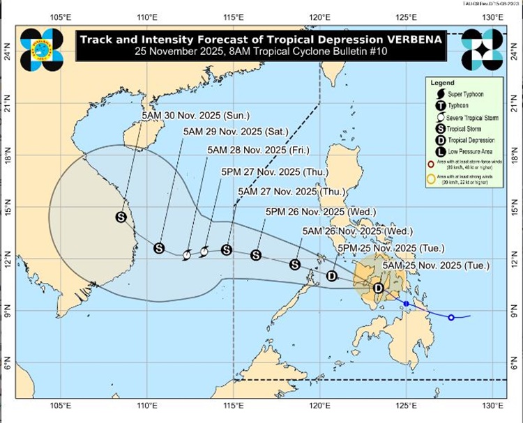
On Tuesday (November 25, 2025), the Philippine Atmospheric, Geophysical and Astronomical Services Administration released the latest weather update in the country. Tropical Depression Verbena will continue to affect the country’s weather conditions.
PAGASA reported that Tropical Depression Verbena maintained its strength as it moved northwestward toward Negros Island.

The storm packs maximum sustained winds of 55 kilometers per hour and gustiness of up to 90 kph, moving northwestward at the speed of 25 kph.
Verbena may reach tropical storm category before reaching northern Palawan. It may peak while in the middle of the West Philippine Sea. The storm is expected to exit the Philippine Area of Responsibility on Thursday morning (November 27).

Here is the list of areas under signal no. 1:
LUZON
- Occidental Mindoro
- Oriental Mindoro
- Romblon
- the northern and central portions of Palawan including Calamian, Cuyo, and Cagayancillo Islands
- mainland Masbate
VISAYAS
- Antique
- Aklan
- Capiz
- Iloilo
- Guimaras
- Negros Occidental
- Negros Oriental
- Siquijor
- Cebu
- Bohol
- Samar
- Eastern Samar
- Biliran
- Leyte
- Southern Leyte
MINDANAO
- Dinagat Islands
- Surigao del Norte
- the northern portion of Surigao del Sur
- Agusan del Norte
- the northeastern portion of Agusan del Sur
- Camiguin
- Misamis Oriental
- the northern portion of Misamis Occidental
- the northern portion of Zamboanga del Norte
“The wind signals warn the public of the general wind threat over an area due to the tropical cyclone. Local winds may be slightly stronger/enhanced in coastal and upland/mountainous areas exposed to winds. Winds are less strong in areas sheltered from the prevailing wind direction,” PAGASA said.
This is a developing report, just visit this website regularly or refresh the page for further updates.