PAGASA: Tropical Storm Nando May Intensify Into Super Typhoon Next Week
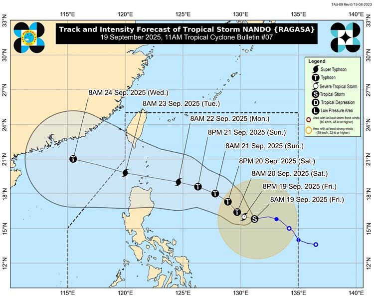
The state weather bureau PAGASA is urging communities to get ready as Tropical Storm Nando shows signs of strengthening into a super typhoon by Monday (September 22, 2025).
Authorities remind the public to secure their homes early and to follow the guidance of local officials once precautionary measures are enforced.
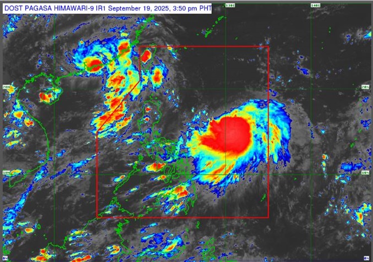
On Friday afternoon (September 19, 2025), Nando was spotted around 1,005 kilometers east of Central Luzon, carried winds of up to 75 kilometers per hour with gusts reaching 90 kilometers per hour. Moving west at a speed of 20 kilometers per hour, the storm is expected to bring stronger winds and heavier rains in the coming days.
Based on the latest track, northern Luzon could face the strongest impact. Weather specialists noted that Batanes and the Babuyan Islands may experience the highest storm signals, with mainland Cagayan including areas such as Santa Ana, Gonzaga, Aparri, and Ballesteros—also at risk of destructive winds and torrential rain.
Forecasts show that rainfall in Cagayan, Batanes, Apayao, and Ilocos Norte may exceed 200 millimeters, which raises concerns about floods and landslides.
Other regions, even those farther from the storm’s path, could still face significant downpours. Provinces such as Zambales, Bataan, Occidental Mindoro, Antique, Aklan, and Palawan may experience more than 100 millimeters of rain daily, while Metro Manila, Central Luzon, Calabarzon, and other parts of Northern Luzon might get at least 50 millimeters.
Storm surges are also a threat, particularly in coastal areas of Batanes, northern Cagayan, northern Ilocos Norte, and the eastern side of the Ilocos Region.
With the storm expected to intensify further, officials emphasize that readiness and cooperation remain the best protection against its possible impact.
This is a developing report, just visit this website regularly or refresh the page for further updates.
RELATED POST: PAGASA Releases Latest Weather Update for Friday (September 19, 2025)